Punta Ballena
| Punta Ballena | ||
|---|---|---|
|
Coordinates: 34 ° 54 ′ S , 55 ° 3 ′ W Punta Ballena on the map of Uruguay
|
||
| Basic data | ||
| Country | Uruguay | |
| Department | Maldonado | |
| Residents | 750 (2011) | |
| Detailed data | ||
| Post Code | 20003 | |
| Casapueblo | ||
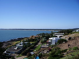
| View from Casapueblo into the bay and Portezuelo | ||
| View of the headland jutting out into the Río de la Plata | ||
Punta Ballena is a town in Uruguay .
geography
It is located in the Maldonado department in sector 1 . Punta Ballena is located, partly on a headland protruding into the Río de la Plata , west of the departmental capital Maldonado and south of the Sierra de la Ballena . It borders the Chihuahua to the west . In the north, behind the Arboretum Lussich, the Laguna del Sauce extends .
Infrastructure
The most striking building in Punta Ballena is the Casapueblo by the artist Carlos Páez Vilaró (1923–2014) who used to live there.
traffic
The route 10 runs through Punta Ballena, which the route 12 meets in the village . A few kilometers to the west is the Capitán de Corbeta Carlos A. Curbelo Airport .
Residents
Punta Ballena had 750 inhabitants in 2011, 401 of them male and 349 female.
| year | Residents |
|---|---|
| 1963 | 107 |
| 1975 | 169 |
| 1985 | 499 |
| 1996 | 799 |
| 2004 | 376 |
| 2011 | 750 |
Source: Instituto Nacional de Estadística de Uruguay
Web links
- City map of Punta Ballena (PDF; 212 kB)
Individual evidence
- ^ Códigos Postales del Interior , accessed February 26, 2012
- ↑ Statistical data ( memento of September 7, 2012 in the Internet Archive ) of the Instituto Nacional de Estadística de Uruguay , accessed on September 27, 2012
- ↑ Statistical data of the Instituto Nacional de Estadística de Uruguay 1963–1996 (DOC; 145 kB)
- ↑ Statistical data from the Instituto Nacional de Estadística de Uruguay 2004 as an xls file ( Memento from March 9, 2013 in the Internet Archive )


