Quionga
| Quionga | ||
|---|---|---|
|
|
||
| Coordinates | 10 ° 36 ′ S , 40 ° 30 ′ E | |
| Basic data | ||
| Country | Mozambique | |
| Cabo Delgado | ||
| District | Palma | |
| ISO 3166-2 | MZ-P | |
| height | 3 m | |
| Residents | 2456 | |
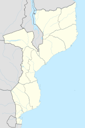
Quionga ( Kionga ) is a place in the far northeast of Mozambique .
geography
Quionga is located on the south bank of the Baía de Quionga ( Kionga Bay ), between Cape Delgado in the south and the mouth of the Rovuma , the border river to Tanzania , into the Indian Ocean . The place belongs to the district of Palma in the province of Cabo Delgado and forms its own administrative post ( Postos administrativos ). At the last census there were 2,456 people in Quionga.
history
The area of the Kionga triangle , which was named after the place, was disputed between the two colonial empires Portugal and the German Empire . In 1916 the Portuguese occupied the area during the First World War , in which there was previously a German outpost. With the Treaty of Versailles , the Kionga triangle was finally assigned to Portugal. In 1920 it was integrated into the Portuguese East Africa colony .
