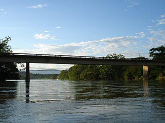
Río Caguán
| Río Caguán | ||
|
Bridge at San Vicente del Caguán |
||
| Data | ||
| location | Department del Caquetá ( Colombia ) | |
| River system | Amazon | |
| Drain over | Río Caquetá (Rio Japurá) → Amazon → Atlantic Ocean | |
| Headwaters | in the south of the Cordillera Oriental 2 ° 38 ′ 2 ″ N , 75 ° 2 ′ 57 ″ W |
|
| Source height | approx. 2800 m | |
| muzzle |
Río Caquetá coordinates: 0 ° 8 ′ 19 ″ S , 74 ° 16 ′ 57 ″ W 0 ° 8 ′ 19 ″ S , 74 ° 16 ′ 57 ″ W. |
|
| Mouth height | approx. 220 m | |
| Height difference | approx. 2580 m | |
| Bottom slope | approx. 3.9 ‰ | |
| length | approx. 670 km | |
| Catchment area | 14,530 km² | |
| Drain |
MQ |
1090 m³ / s |
| Left tributaries | Río Pato | |
| Right tributaries | Río Guayas , Río Sunsiya | |
| Medium-sized cities | Cartagena del Chairá , San Vicente del Caguán | |
The Río Caguán is an approx. 670 km long left tributary of the Río Caquetá in the south of Colombia .
River course
The Río Caguán rises in the south of the Cordillera Oriental , 255 km south-southwest of the capital Bogotá at an altitude of about 2800 m . It initially flows 30 km in an east-southeast direction through the mountains. The river then turns 30 km to the south before cutting a range of hills to the east. It then flows 10 km to the north, again cutting through a ridge in an easterly direction. At river kilometer 570 the Río Pato meets the Río Caquetá from the left. This now turns south, breaks through one last ridge and leaves the mountains. It now flows through the Amazon lowlands at the foot of the Cordilleras in a southerly direction, forming numerous river loops . At river km 530 the city of San Vicente del Caguán is on the right bank of the river. At river kilometer 400 the Río Guayas flows into the river from the right. Cartagena del Chairá is located 10 kilometers downstream on the right bank of the river. At river kilometer 205 the Río Sunsiya meets the river on the right side. This meanders in a southeastern direction through the jungle. For the last 100 kilometers, the Río Caguán turns again to the south and finally flows into the Río Caquetá, which flows eastwards at an altitude of about 220 m , which bears the name Rio Japurá in the lower reaches of Brazil and flows into the Amazon . The entire course of the Río Caguán lies within the Departamento del Caquetá .
Hydrology and catchment area
The catchment area of the Río Caguán covers 14,530 km². The mean discharge is 1090 m³ / s.
