Río Santa Bárbara
| Río Santa Bárbara | ||
|
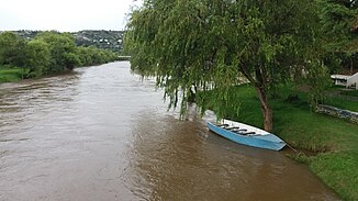
Río Santa Bárbara near Gualaceo |
||
| Data | ||
| location | Province of Azuay in Ecuador | |
| River system | Amazon | |
| Drain over | Río Paute → Río Namangoza → Río Santiago → Río Marañón → Amazon → Atlantic Ocean | |
| origin | Laguna Santa Bárbara 3 ° 7 ′ 21 ″ S , 78 ° 42 ′ 18 ″ W |
|
| Source height | approx. 3400 m | |
| Association with |
Río Cuenca to Río Paute Coordinates: 2 ° 51 ′ 36 ″ S , 78 ° 46 ′ 22 ″ W 2 ° 51 ′ 36 ″ S , 78 ° 46 ′ 22 ″ W. |
|
| Mouth height | approx. 2200 m | |
| Height difference | approx. 1200 m | |
| Bottom slope | approx. 24 ‰ | |
| length | 50 km | |
| Catchment area | 947 km² | |
| Left tributaries | Río Pamar | |
| Right tributaries | Río Zhio, Río Gutag, Río San José | |
| Medium-sized cities | Gualaceo | |
| Small towns | Sígsig | |
The Río Santa Bárbara is the 50 km long right source river of the Río Paute in the province of Azuay in the south of Ecuador .
River course
The Río Santa Bárbara has its origin in the approximately 3400 m high mountain lake Laguna Santa Bárbara in the Cordillera Real . It initially flows 10 km to the west and then turns north. At river kilometer 29 he passes the small town of Sígsig . The city of Gualaceo is five kilometers above the estuary . The Río Santa Bárbara meets the Río Cuenca coming from the west , with which it joins the Río Paute. The catchment area covers 947 km².
Web links
Commons : Río Santa Bárbara - Collection of images, videos and audio files
