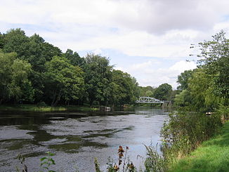
Rönne å
|
Rönne å Rönneån |
||
|
Rönne å at Ängelholm |
||
| Data | ||
| location | Skåne län ( Sweden ) | |
| River system | Rönne å | |
| origin | Lake Ringsjön 55 ° 54 ′ 42 ″ N , 13 ° 26 ′ 32 ″ E |
|
| Source height | 53.5 m above sea level | |
| muzzle | to Skälderviken Bay ( Kattegat ) Coordinates: 56 ° 16 ′ 20 " N , 12 ° 49 ′ 52" E 56 ° 16 ′ 20 " N , 12 ° 49 ′ 52" E |
|
| Mouth height | 0 m o.h. | |
| Height difference | 53.5 m | |
| Bottom slope | 0.64 ‰ | |
| length | 83 km (including source rivers 120 km) | |
| Catchment area | 1,896.6 km² | |
| Drain |
MQ |
22 m³ / s |
| Left tributaries | Klövabäcken | |
| Right tributaries | Ybbarpsån, Bäljane å, Pinnån, Kägleån | |
| Medium-sized cities | Ängelholm | |
The Rönne å (also Rönneån ) is a river in the province of Skåne län in the south of Sweden .
The river forms the outflow of the Ringsjön in the center of Skåne . It flows in a north-westerly direction to Ängelholm , where it flows into the Skälderviken Bay and the Kattegat .
The river has a length of 83 km, including headwaters, it is 120 km. It drains an area of 1896.6 km². The mean flow rate is 22 m³ / s.
Hörbyån , a tributary of the Ringsjön, forms the source of the Rönne å.
Three hydropower plants with a total output of 2.7 MW are located on the river.
Individual evidence
- ↑ Sveriges Meteorologiska och Hydrologiska Institut (SMHI) - Län och huvudavrinningsområden i Sverige (PDF; 2.5 MB)
