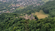
Röttelnweiler
Röttelnweiler is a hamlet in the Baden-Württemberg city of Lörrach . The hamlet at 309 m above sea level. NN Höhe lies directly at the foot of Rötteln Castle and was founded in the 13th century. Röttelnweiler should not be confused with the hamlet of Rötteln .
history
In the settlement, which was created by fishermen in the 13th century, there were owners of the Basel church, which was given as a fief by the bishop during the time of the margraves . The name resulted from the designations in 1365 "in the wiler" and 1551 "in Rötteln in the hamlet". After 1678 the destroyed castle complex was assigned to Röttelnweiler, which in turn was politically united with the bailiwick of Haagens . Nevertheless, Röttelnweiler received its own rod holder in the 18th century .
In 1781 36 people lived in Röttelnweiler, ten in Hasenloch. It is known that an oil trot was converted into a loh pounder in 1738/39 and into a fulling mill in 1750 . A corresponding Tafern license was granted in 1691. The industry was shut down around 1700 due to the war, but existed again in 1726.
At the beginning of the 19th century, Röttelnweiler had 41 residents and consisted of five residential buildings and 14 outbuildings. The Röttler Mühle belonging to Röttelnweiler had nine residents. On April 9, 1848, Markus Pflüger made his first political appearance as the chairman of the Patriotic Comitès as part of the Baden Revolution . The event in Röttelnweiler was attended by around 600 people.
With the incorporation of Haag in 1974, Röttelnweiler also became part of the city of Lörrach. In 2012 Röttelnweiler had 228 inhabitants.
Location and geography
Röttelnweiler is located on the main road (Röttler Strasse) in a valley between the centers of Tumringen and Haagen. North of Röttler Straße, at an S-curve of the connecting road, the access road to the hamlet branches off. The place is formed from a ring road, from which some secondary roads branch off. All addresses have the street name "Röttelnweiler" with the corresponding number.
A junction crosses the A 98 , at which Weiler is located, which leads in a steep street to Rötteln Castle. The Röttler pond runs south of Röttelnweiler . A footpath leads from Röttelnweiler to Rötteln, around 300 meters further west .
literature
- Landesarchivdirektion Baden-Württemberg, Landkreis Lörrach (ed.): Der Landkreis Lörrach , Volume II (Kandern to Zell im Wiesental), Jan Thorbecke Verlag Sigmaringen 1994, ISBN 3-7995-1354-X , p. 139.
Web links
- Regional information system for Baden-Württemberg : Röttelnweiler residential area - archive material
Individual evidence
- ↑ Landkreis Lörrach (Ed.): Der Landkreis Lörrach , Volume II, p. 139.
- ^ Geographical-statistical-topographical description of the Kurfürstenthume Baden , Volume 1, Verlag der Ch. Fr. Müller'schen Buchhandlung and Hofbuchdruckerey, 1804, p. 401.
- ↑ Ute gray, Georg Hertweck, Jürgen Schuhladen-Krämer: Revolution in the southwest. Sites of the democracy movement 1848/49 in Baden-Württemberg. Info Verlagsgesellschaft, 1998, ISBN 978-3881902199 , p. 372.
- ↑ Ute gray, Georg Hertweck, Jürgen Schuhladen-Krämer: Revolution in the southwest. Sites of the democracy movement 1848/49 in Baden-Württemberg. Info Verlagsgesellschaft, 1998, ISBN 978-3881902199 , p. 366.
- ↑ Helmut Opitz: Müller's Grosses Deutsches Ortsbuch 2012: Complete local dictionary. De Gruyter Saur, 2012, ISBN 978-3110278064 , p. 1168
Coordinates: 47 ° 37 ′ 59.5 ″ N , 7 ° 39 ′ 55.8 ″ E


