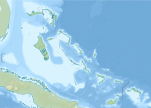
Ragged Island (Bahamas)
| Ragged Island | ||
|---|---|---|
| Waters | Atlantic Ocean | |
| Archipelago | Bahamas | |
| Geographical location | 22 ° 13 '22 " N , 75 ° 43' 49" W | |
|
|
||
| length | 7 km | |
| width | 2.9 km | |
| surface | 15 km² | |
| Highest elevation | South Side Hill 13 m |
|
| Residents | 70 (2010) 4.7 inhabitants / km² |
|
| main place | Duncan Town | |
Ragged Island is a small island in the south of the Bahamas , with an area of around 15 km².
Until recently there was a salt industry on the island, founded by Duncan Taylor in the 19th century . The only town, Duncan Town , was named after him.
The island was devastated by Hurricane Donna in September 1960 and was subsequently abandoned by many residents. The population was only 70 in 2010, after 89 at the 1990 census and 72 ten years later. On September 8, 2017, Hurricane Irma wandered with his eye over Ragged Island and its main town, Duncan, leaving havoc. The population was previously evacuated to New Providence by order of the government .
Ragged Island is part of the Jumentos cays and Ragged Island Chain . Here you will find the famous islands of Racoon Cay , Hog Cay and Double-Breasted Cay .
Duncan Town is the only settlement in the island chain and is located in a bay with shallow water. The island is supplied exclusively by a mail boat. It also has a small airstrip and port.
Most of the residents are direct descendants of the first settlers and have names such as Curling, Lockhart, Maycock, Munroe, Wallace and Wilson.
Despite their remoteness and small population, many residents hold important positions in politics, sports, entertainment and business.
