Rum Cay
| Rum Cay | ||
|---|---|---|
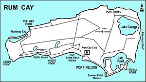
| Detailed map of Rum Cay | ||
| Waters | Atlantic Ocean | |
| Archipelago | Bahamas | |
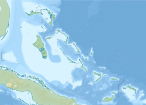
| Geographical location | 23 ° 40 '56 " N , 74 ° 52' 8" W | |
|
|
||
| surface | 40 km² | |
| Highest elevation | 37 m | |
| Residents | 99 (2010) 2.5 inhabitants / km² |
|
| main place | Port Nelson | |
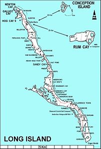
| Rum Cay east of Long Island | ||
Rum Cay is an approximately 40 km² island and a district of the Bahamas .
Rum Cay is located 32 km south of San Salvador and is a flat island with rolling hills that rise up to 37 m. Christopher Columbus named the island Santa Maria de la Concepción . It is believed that the island's name comes from a sunk shipload of rum . The main town is Port Nelson , a picturesque village between coconut palm groves.
history
The island was first called Mamana by the Lucayan Indians and later renamed Santa María de la Concepción by Columbus . Spanish researchers found a rum barrel washed up on the beach and then renamed the island again Rum Cay . In 2010 the island had 99 residents. It was settled in the 19th century by loyalists who fled the American Revolutionary War.
To the north there is an interesting cave with Lucayan drawings and stone figures. Numerous artefacts from the Arawak period were found by farmers in the fertile soil that the Indians had already fertilized with bat guano . Together with other islands, Rum Cay has an eventful history. The cultivation of oranges and sisal and the extraction of salt were once important industries, but due to competition and natural disasters, these industries are no longer important today. The main source of income is now tourism.
population
The majority of the population now lives in Port Nelson. Settlements like Port Boyd, Black Rock and Gin Hill are now deserted and overgrown.
nature
The Summer Point Reef and Pinder's Point reefs that surround this former pirate port are popular diving destinations. At the Grand Canyon , the huge corals almost reach the surface of the water. At the Summer Point Marina there are moorings, bars and restaurants, as well as a small guest house that can be rented. The Last Chance Yacht Supply marina offers shopping and is used by boats en route to Mayaguana to the Turks and Caicos Islands or other points in the north.
Divers can still find parts of the HMS Conqueror , the Royal Navy's first screw-powered warship here. The ship sank in 1861 and is about ten meters deep.
traffic
There is an airport on the island with the IATA airport code RCY.


