
Atbaschy district

The Atbaschy Rajon (Kyrgyz: Ат-Башы) is a Rajon ( district ) in the extreme south of the Naryn region of the Central Asian Republic of Kyrgyzstan . It borders in the south on the Uyghur Autonomous Region Xinjiang of China , which is reached via the 3752 m high Torugart Pass . The Rajon has the COATE number 41704220000000.
landscape
The area of the Rajons consists of high mountain ranges and some high mountain plateaus, all of which are at an altitude of more than 2000 m and in the extreme south even over 3000 m. The 135 km long Atbaschy mountain range , which crosses the Rajon from east-northeast to west-southwest, rises to an altitude of 4786 m, the Torugart Mountains in the south to 5108 m. The most important rivers are the Aksai , Atbaschy and Karakojun . Close to the Torugart Pass, at an altitude of 3520 m, lies the 170.6 km² lake Chatyrköl (Kyrgyz: Чатыркөл) with no outflow.
Population, traffic, tourism
The 15,354 km² large Rajon is only very sparsely populated due to its geography and climate: its population was 61,793 people in 2015. The administrative seat of the Rajon is in the village of Atbaschy. The national road EM-07 (formerly Soviet A365), which leads from the regional capital Naryn to the Torugart Pass and to Kashgar in Xinjiang, runs through the Rajon for its last 180 km.
In addition to the impressive high mountain landscape , the well-preserved former caravanserai Tash Rabat (Kyrgyz: Таш Рабат) from the 15th century is worth seeing ; it stands at 3105 m altitude in the valley of the Tasch Rabat , a tributary of the Karakojun on its upper reaches.

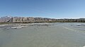
The village of Atbaschy

Live cattle market in Atbaschy (July 2012)
The Atbaschy River

Landscape in the south of the Rajons

Typical slope in the Atbaschy basin

The EM-07 road (formerly A365) to the Torugart Pass

Tash Rabat

The Chatyrköl Lake and the Torugart Mountains


Administrative division
The Rajon is divided into eleven rural communities (aiyl okrug), which consist of a total of 19 villages. These are:
| local community | Kyrgyz | COATE number | Village | Kyrgyz | COATE number | Population (2015) |
|---|---|---|---|---|---|---|
| Ak-Jar | Ак-Жар | 41704220803000 | Ak-Jar | Ак-Жар | 41704220803010 | 5273 |
| Ak-Moyun | Ак-Моюн | 41704220806000 | Ak-Moyun Birlik |
Ак-Моюн Бирлик |
41704220806010 41704220806020 |
2502
1478 |
| Ak-Mus | Ак-Муз | 41704220807000 | Ak-Mus | Ак-Муз | 41704220807010 | 3893 |
| Ak-talaa | Ак-Талаа | 41704220808000 | Kalinin Terek-Suu |
Калинин Терек-Суу |
41704220808010 41704220808020 |
3391 2022 |
| Atbaschy | Ат-Башы | 41704220812000 | Atbaschy | Ат-Башы | 41704220812010 | 13690 |
| Acha-Kaiyndy | Ача-Кайыңды | 41704220813000 | Acha-Kaiyndy | Ача-Кайыңды | 41704220813010 | 4371 |
| Bash Kaiyndy | Баш-Кайыңды | 41704220817000 | Bash Kaiyndy Bolshevik |
Баш-Кайыңды Большевик |
41704220817010 41704220817020 |
4752
1031 |
| Kasybek | Казыбек | 41704220830000 | Kasybek Dschany-Kutsch |
Казыбек Жаңы-Күч |
41704220830010 41704220830020 |
4520 1104 |
| Kara Kojun | Кара-Коюн | 41704220832000 |
Kyzyl-Tuu Kara-Bulun |
Кызыл-Туу Кара-Булуң |
41704220832010 41704220832020 |
2076 1731 |
| Kara-suu | Кара-Суу | 41704220836000 | Kara-suu Dyikan |
Кара-Суу Дыйкан |
41704220836010 41704220836020 |
5428 1042 |
| Taldy-Suu | Талды-Суу | 41704220845000 | Taldy-Suu Özgörusch |
Талды-Суу
Өзгөрүш |
41704220845010 41704220845010 |
1634 761 |
Coordinates: 41 ° 6 ′ 0 ″ N , 75 ° 36 ′ 0 ″ E
Footnotes
- ↑ СОАТЕ = Система обозначений объектов административно-территриальных и территориальных единиц Кыргызской Республики (System of Identification of objects of administrative-territorial and territorial units of the Kyrgyz Republic)
- ↑ 1 January 2015: Национальный статистический комитет Кыргызской Республики: Численность постоянного сельского населения Кыргызской Республики по айылным аймакам и айылам (селам) в 2015 г. (National Statistical Committee of the Kyrgyz Republic: Number of permanent rural population of the Kyrgyz Republic by Aiyl-Aimaks and Aiyls (villages) in 2015 ), accessed December 12, 2019
- ↑ Национальный статистический комитет Кыргызской Республики: Численность постоянного сельского населения Кыргызской Республики по айылным аймакам и айылам (селам) в 2015 г. (National Statistical Committee of the Kyrgyz Republic: Number of permanent rural population of the Kyrgyz Republic according to Aiyl-Aimaks and Aiyls (villages) in 2015 ), accessed December 16, 2019