
Rantzau (river)
| Rantzau | ||
 The Rantzau in Winseldorf |
||
| Data | ||
| Water code | DE : 597676 | |
| location | Schleswig-Holstein , Germany | |
| River system | Elbe | |
| Drain over | Stör → Elbe → North Sea | |
| source | Northeast of Peissen | |
| muzzle | In the Stör coordinates: 53 ° 55 '34 " N , 9 ° 37' 17" E 53 ° 55 '34 " N , 9 ° 37' 17" E
|
|
| length | 15 km | |
| Catchment area | 69.5 km² | |
| Left tributaries | Steinteichgraben (Hohenlockstedt receiving water) | |
| Right tributaries | Schlotfelder Graben (Schlotfeld receiving water) | |
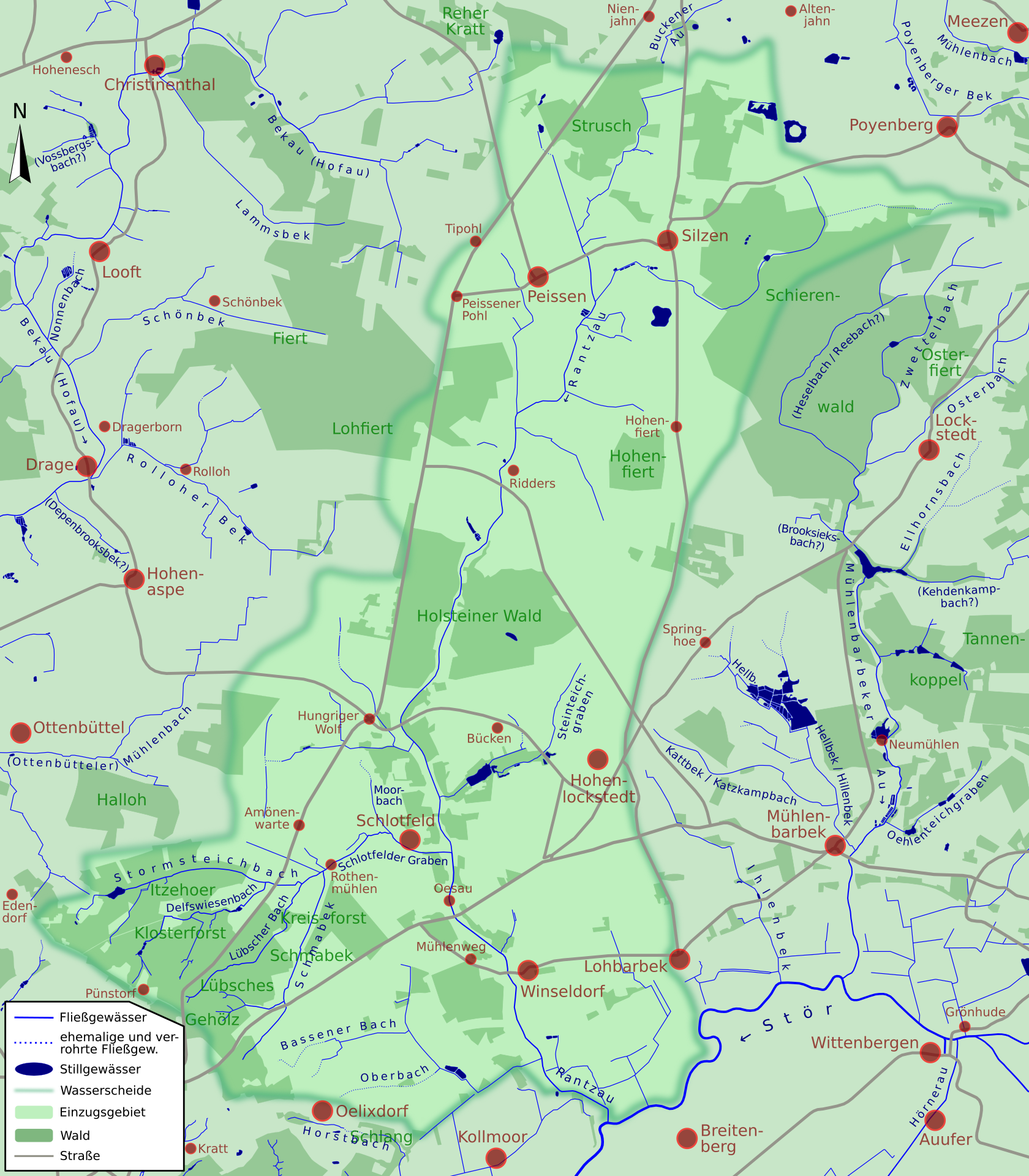
The Rantzau is a right tributary of the Stör in the Steinburg district .
The Rantzau is approx. 15 km long and has its source northeast of Peissen . From there it flows south through Ridders , from there parallel to federal highway 77 further south, crosses under the B 206 between Schlotfeld and Hohenlockstedt in a south-easterly direction and then flows through Winseldorf . It finally flows into the Stör via a sluice and, in the event of high water, via a pumping station at river kilometer 42.9.
Important tributaries of the Rantzau are the outfall Silzen from the Schierwaldenrath , the stone Teichgraben (outfall Hohenlockstedt) and the vent fields trench (outfall Schlotfeld). Its catchment area covers around 6,950 hectares. Several of the streams running towards the Rantzau and draining via the Schlotfelder Graben are sand-shaped rivers .
The Rantzau and the adjacent valley area are part of the FFH area Rantzau valley from Ridders onwards .
swell
- ↑ Water Association Bekau - Dike and Sielverband Rantzau
- ↑ Water Association Bekau - Dike and Sielverband Rantzau