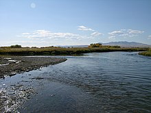
Jefferson River
| Jefferson River | ||
|
Jefferson-Beaverhead-Red Rock River |
||
| Data | ||
| Water code | US : 785443 | |
| location | Montana (USA) | |
| River system | Mississippi | |
| Drain over | Missouri → Mississippi → Gulf of Mexico | |
| origin | Confluence of the Beaverhead and Big Hole Rivers 45 ° 34 ′ 5 ″ N , 112 ° 20 ′ 21 ″ W |
|
| Source height | 1405 m ( at the confluence ) | |
| confluence | with the Madison River to Missouri at Three Forks Coordinates: 45 ° 55 ′ 39 ″ N , 111 ° 30 ′ 29 ″ W 45 ° 55 ′ 39 ″ N , 111 ° 30 ′ 29 ″ W |
|
| Mouth height | 1232 m | |
| Height difference | 173 m | |
| Bottom slope | 1.4 ‰ | |
| length | 124 km ( with Red Rock River 375 km ) | |
The Jefferson River is a river in the US state of Montana . It is one of the two rivers, the confluence of which in Missouri Headwaters State Park near Three Forks creates the Missouri River .
The Jefferson River is 375 kilometers long with its right source Beaverhead River (126 kilometers) and its source river Red Rock River (151 kilometers) and has its source in the Centennial Mountains ( Rocky Mountains ), near the North American watershed west of the border to Idaho .
River course
Red Rock River
The Red Rock River rises on the southeast slope of Mount Jefferson (3109 m), right on the border with Idaho , in Brower's Spring. The source is located at about 2,750 m and is recognized as the origin of the Missouri. It is named after Jacob V. Brower, who declared it to be of Missouri origin in 1896 and provided it with an engraved copper plate. The Red Rock River first flows west and then continues north. It flows through the Upper and Lower Red Rock Lake and the Lima Reservoir. Past the town of Lima , the river runs parallel to Interstate 15 . In the Clark Canyon Reservoir, the Red Rock River joins the Horse Prairie Creek coming from the west to form the Beaverhead River.
Beaverhead River
The Beaverhead River flows northeast parallel to Interstate 15 . It flows through Dillon . A little south of the town of Twin Bridges the Beaverhead takes up the Ruby and joins north of the town with the Big Hole River to form the Jefferson River.
Jefferson River
The Jefferson River now flows further northeast and forms the Missouri about 2.5 kilometers southwest of the town of Trident by the confluence with the Madison River . The city of Bozeman is 46 kilometers southeast and the village of Three Forks is seven kilometers southwest of the confluence of the two rivers.
The Jefferson River was named in 1805 by Lewis and Clark in honor of US President Thomas Jefferson .


