Relief inlet
| Relief inlet | ||
|---|---|---|
|
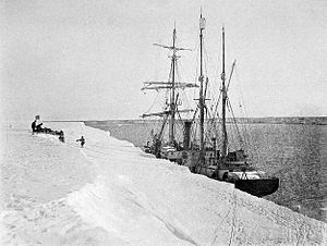
Rescue of the northern group of the Nimrod expedition at Relief Inlet on February 4, 1909 |
||
| Waters | Terra Nova Bay | |
| Land mass | Victoria Land , East Antarctica | |
| Geographical location | 75 ° 13 ′ 0 ″ S , 163 ° 45 ′ 0 ″ E | |
|
|
||
|
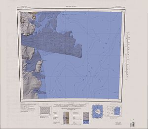
Map with the relief inlet on the northern edge of the Drygalski ice tongue (top center) |
||
The Relief Inlet ( English for "Bay of Redemption") is a bay in the southwest corner of Terra Nova Bay on the Scott coast of East Antarctica Victoria Land . It is limited by the northern edge of the Drygalski ice tongue and the southern foothills of the Nansen ice table .
The bay was discovered by participants in the Nimrod expedition (1907-1909) led by the British polar explorer Ernest Shackleton . It was named after the rescue of the three-headed northern group of the expedition, believed to be lost, on February 4, 1909, which was picked up by the expedition ship Nimrod after their return from the Antarctic magnetic pole in this bay .
See also
Web links
- Relief Inlet in the Geographic Names Information System of the United States Geological Survey (English)
- Relief Inlet on geographic.org (English)
- Relief inlet. In: Kenneth J. Bertrand and Fred G. Alberts: Geographic names of Antarctica , US Govt. Print. Off., Washington 1956, p. 256 (English)


