Reutberger Mühlbach
| Reutberger Mühlbach | ||
|
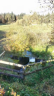
Reutberger Mühlbach at the outlet of the Mühlweiher. |
||
| Data | ||
| location |
Ammer-Loisach-Jungmoränenland
|
|
| River system | Danube | |
| Drain over | Kirchseebach → Teufelsgraben (dry valley) → Mangfall → Inn → Danube → Black Sea | |
| source |
Sachsenkam 47 ° 48 ′ 25 ″ N , 11 ° 38 ′ 26 ″ E |
|
| Source height | 709 m | |
| muzzle | Kirchseebach Coordinates: 47 ° 49 '8 " N , 11 ° 37' 52" E 47 ° 49 '8 " N , 11 ° 37' 52" E |
|
| Mouth height | approx. 699 m | |
| Height difference | approx. 10 m | |
| Bottom slope | approx. 4.8 ‰ | |
| length | approx. 2.1 km | |
The Reutberger Mühlbach is a river in the Bad Tölz-Wolfratshausen district .
course
The headwaters of the Reutberger Mühlbach lies west-northwest of Sachsenkam between the Mühlweiher in the east and the Neuweiher in the west.
It initially runs northwards, first following the course of the mill pond , then that of the Neuweiher . The Mülbach flows down the river near Reuberg Monastery and then continues towards the northwest.
The river flows into a fork in the moss (Upper German for moor ) around the Kirchsee . In a north-easterly direction it flows from this into the Kirchseebach . Before it flows into the Kirchsee, it flows in a south-westerly direction into the Kalterbach , which drains via an infiltration stretch in the Teufelsgraben towards Mangfall .


