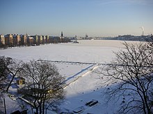
Riddarfjärden
Coordinates: 59 ° 19 ′ 26 ″ N , 18 ° 3 ′ 0 ″ E
The Riddarfjärden is the easternmost bay of the Mälaren and belongs entirely to the urban area of Stockholm . Fjärd , Fjord and Förde are different types of bays of glacial origin.
Riddarfjärden extends in an east-west direction and is bounded in the west by the district of Mariaberget and the Västerbron bridge , as well as the former prison island Långholmen , in the north by the district of Kungsholmen and the Norr Mälarstrand street , in the east by the islands of Riddarholmen and Gamla Stan , and in the south of the Södermalm district and the Söder Mälarstrand road .
Riddarfjärden is around 2,700 meters long and around 400 meters wide, the beach line is 6400 meters and the greatest depth is around 23 meters.
There are some interesting buildings around Riddarfjärden. The best known is the Stockholm stadshus on the north-eastern part of Riddarfjärden. To the west, Stockholm's highest bridge, the Västerbron , spans the bay. To the east are the locks and the Slussen traffic junction as well as the old town Gamla Stan . At Slussen , the fresh water of Lake Mälaren meets the salt water of the Baltic Sea. The water is so clean that you can swim in the middle of the city; the baths at Smedsudden and Långholmen are also available. The Riddarfjärds swim between Smedsudden and Stadshuset has been held annually since 1976. In 2007 there was a proposal by the architect Thomas Sandell to build a floating bathing hotel in the middle of Riddarfjärden.


