
Rintger Bach
| Rintger Bach | ||
 The Rintger Bach flows into the Alsbach |
||
| Data | ||
| location | District of Viersen , North Rhine-Westphalia , Germany | |
| River system | Rhine | |
| Drain over | Rintger Bach → Niers → Maas → Hollands Diep → North Sea | |
| River basin district | Meuse | |
| source | At the cloister pond in Viersen in the Viersen district 51 ° 15 ′ 4 ″ N , 6 ° 23 ′ 16 ″ E |
|
| Source height | approx. 52 m above sea level NN | |
| muzzle | in the Alsbach coordinates: 51 ° 15 ′ 47 " N , 6 ° 24 ′ 42" E 51 ° 15 ′ 47 " N , 6 ° 24 ′ 42" E |
|
| Mouth height | approx. 38 m above sea level NN | |
| Height difference | approx. 14 m | |
The Rintger Bach is a left tributary of the Niers in the Lower Rhine district of Viersen .
Bach description
In the district Rintgen there used insgemein three streams which the designation Rintger Bach in the vernacular led. The main stream originated in three springs on the south side of the street Am Klosterweiher . There he formed a pond . He then ran to the street Am Kloster , drove the monastery mill and flowed through the gardens between Hohlstrasse and Heierstrasse under a bridge on Gladbacher Strasse to Bleichstrasse. There he formed several moats at the Rintger Bleiche . It then crossed Neumarkt, today Gereonplatz, ran through Rintger and Krefelder Strasse on the south side, turned north in front of Rintger Schanze at the beginning of Robend and flows into the Dorfer Bach in the Kalverbenden .
The second Rintger Bach, also called Rinne , originated on the grounds of the Beckershof, today Klosterstrasse No. 2 and 2a. It joined the main stream on Krefelder Strasse.
The third Rintger Bach sprang in the garden of Bryshofes, today the economic Am Kloster no. 23. There he formed a pond and resulted in the Pielbach that flowed to the house sticks in the right arm of villages creek.
In rainy seasons and when the snow melted, the three Rintger brooks rose over their banks and flooded Neumarkt, today Gereonsplatz, for days. As a patron saint against water shortages, a Santa Claus stick was therefore set up on Neumarkt.
The Rintger Bach no longer exists in its form. Some of the water is drained through the sewer system. From the corner of Hülsdonk and Oststraße it flows as an open ditch in an easterly direction, takes in the Dorfer Bach and then flows east into the Alsbach . The care and maintenance of the water is the responsibility of the water and soil association of the Middle Niers, which is based in Grefrath .
Mill on the Rintger Bach
The monastery mill stood on the Rintger Bach from the 11th to the end of the 19th century.
gallery

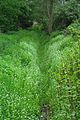
Stream bed at the Hormesfeld
Stream course of the Rintger Bach


literature
- Niederrheinischer Wassermühlen-Führer, by Hans Vogt, pp. 511-523
- From the water system in Alten Viersen, by Ferdinand Dohr, Heimatbuch Kreis Viersen 1974, pp. 47–55