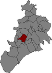
Riudecanyes
| Riudecanyes municipality | ||
|---|---|---|
| coat of arms | Map of Spain | |

|
|
|
| Basic data | ||
| Autonomous Community : |
|
|
| Province : | Tarragona | |
| Comarca : | Baix Camp | |
| Coordinates | 41 ° 8 ′ N , 0 ° 58 ′ E | |
| Height : | 195 msnm | |
| Area : | 17.05 km² | |
| Residents : | 1,124 (Jan 1, 2019) | |
| Population density : | 65.92 inhabitants / km² | |
| Postal code : | 43771 | |
| Municipality number ( INE ): | 43127 | |
| Location of the municipality | ||

|
||
Riudecanyes is a Spanish village in the hinterland of Reus , which is mainly characterized by agriculture. Several hundred people live in Riudecanyes. Olive plantations dominate the landscape, interrupted by a reservoir, which also supplies Reus with water. In the village, the local agricultural cooperative sells local produce (mainly olives and olive oil).
Above Riudecanyes is the Castell Monestir d'Escornalbou , an abandoned monastery from the 13th century that was converted into a villa at the beginning of the 20th century.
Riudecanyes is part of the Baix Camp district .
Web links
Commons : Riudecanyes - collection of images, videos and audio files
- Official website of Riudecanyes
- Information and photos about the village and the Castell d'Escornalbou
Individual evidence
- ↑ Cifras oficiales de población resultantes de la revisión del Padrón municipal a 1 de enero . Population statistics from the Instituto Nacional de Estadística (population update).

