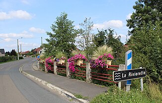
Rivièrette
| Rivièrette | ||
|
The river in Landrecies |
||
| Data | ||
| Water code | FR : D0110600 | |
| location | France | |
| River system | Rhine | |
| Drain over | Sambre → Maas → Rhine delta → North Sea | |
| source | in the municipality of Fontenelle 50 ° 1 ′ 50 ″ N , 3 ° 50 ′ 55 ″ E |
|
| Source height | approx. 216 m | |
| muzzle | in the municipality of Landrecies in the Sambre coordinates: 50 ° 7 ′ 18 ″ N , 3 ° 40 ′ 52 ″ E 50 ° 7 ′ 18 ″ N , 3 ° 40 ′ 52 ″ E |
|
| Mouth height | approx. 135 m | |
| Height difference | approx. 81 m | |
| Bottom slope | approx. 4.1 ‰ | |
| length | approx. 20 km | |
The Rivièrette (spelling also Riviérette or Rivierette ) is an approximately twenty kilometers long stream in France that runs in the Hauts-de-France region . It is a right tributary of the Sambre .
geography
course
The Rivièrette rises in the municipality of Fontenelle at an altitude of about 216 m , generally drains north-west through the Avesnois Regional Nature Park and, after a total of around 20 kilometers, flows into the municipality of Landrecies at a height of about 135 m as a right tributary into the Sambre , the here has been expanded to become the Canal de la Sambre à l'Oise canal . On its way, the Rivièrette crosses the Aisne and Nord departments .
Tributaries
- Ferme Sainte-Marie ( left ), 1.2 km
- Le Gravier ( left ), 3.0 km
- Fontaine aux moines ( left ), 1.4 km
- Le Petit Béart [D0110710] (left), 1.1 km
- Le Petit Béart [D0110720] (left), 1.3 km
- Rieu de Jument ( right ), 1.4 km
- Le Grand Debout ( right ), 1.1 km
- Le Sambreton ( left ), 1.1 km
- Ruisseau de la grande fontaine du bois du toillon ( left ), 5.0 km
Places on the river
(Order in flow direction)
- Beaurepaire-sur-Sambre
- Prisches
- Le Grand Béart , municipality of Prisches
- Le Favril
- Landrecies
