
Rochester (Northumberland)
| Rochester | |||
|---|---|---|---|
|
|||
| Coordinates | 55 ° 17 ′ N , 2 ° 16 ′ W | ||
| Basic data | |||
| Country | United Kingdom | ||
|
Part of the country |
England | ||
| county | Northumberland | ||
| ISO 3166-2 | GB-NBL | ||
| North East England | |||
 Dere Street to Bremenium
|
|||

Rochester is a small town in northern Northumberland ( England ). It is northeast of Otterburn on the Corbridge to Jedburgh road . The city is part of the parliamentary constituency of Hexham .
history
Rochester is the site of the former Roman fort Bremenium , which was built to protect the important Roman road (now Dere Street ) that runs through the center of the village. This road connected Eboracum ( York ) with the Antonine Wall in what is now Scotland . A military unit of the Roman army, the Cohors Primae Lingonum Equitata , which consisted primarily of lingons , was u. a. stationed there. A shrine was found from her with an inscription for the deity Matunus .
Here is the Three Kings , about six kilometers northwest, a four-post stone circle (Engl. Four-poster stone circle ), are of which only three stones, the fourth has fallen. This monument consists of four menhirs that mark the corners of a square. The heaviest of the stones weighs 2.5 t. It is a grave complex, in its center there was a small walled shaft for the ashes of the deceased. The stone setting dates from the Bronze Age and is comparable to the Goatstones near Ravensheugh Crags, also in Northumberland.
Picture gallery

The three kings

Roman tomb on Dere Street

School extension made from Roman stones

War memorial

Souvenir shop
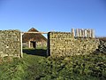
reconstructed farm


