Rockford (Michigan)
| Rockford | ||
|---|---|---|
|
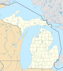
Location in Michigan
|
||
| Basic data | ||
| State : | United States | |
| State : | Michigan | |
| County : | Kent County | |
| Coordinates : | 43 ° 7 ′ N , 85 ° 34 ′ W | |
| Time zone : | Eastern ( UTC − 5 / −4 ) | |
| Residents : | 4,626 (as of: 2000) | |
| Population density : | 593.1 inhabitants per km 2 | |
| Area : | 7.8 km 2 (about 3 mi 2 ) of which 7.8 km 2 (about 3 mi 2 ) is land |
|
| Height : | 214 m | |
| Postcodes : | 49341, 49351 | |
| Area code : | +1 616 | |
| FIPS : | 26-69080 | |
| GNIS ID : | 0636089 | |
| Website : | www.rockford.mi.us | |
Rockford is a small town in Kent County near Grand Rapids in the US state of Michigan . The city has 4626 inhabitants and is located on the Rogue River .
geography
Rockford is located in the southwest of Michigan, about 45 km east of Lake Michigan and has an area of 7.8 km² without any significant water surface. The distance to Chicago in the southwest is approximately 265 km and to Detroit in the southeast approximately 280 km.
history
The Rockford area was probably inhabited by Indians . However, no traces of the Hopewell , Mascoutah or Ottawa settlements have been found. The first land surveyors of the 19th century reported that the Indians were trampled on.
The first recorded resident of what is now Rockford was Smith Lapham , who moved from Washtenaw County to Kent County in 1843 and built a sawmill there in 1844. In 1845 the place consisted of 5 houses. The connection to the Grand Rapids and Indiana Railroad in 1865 brought the city a population increase to 315 people in 1866.
recreation
The White Pine Trail State Park runs through town. This park is an educational trail that runs 140 km from Grand Rapids to Cadillac , Michigan.
