Rolfsbüttel
|
Rolfsbüttel
Adenbüttel municipality
Coordinates: 52 ° 23 ′ 44 ″ N , 10 ° 25 ′ 28 ″ E
|
|
|---|---|
| Height : | 65 m |
| Residents : | 290 (December 31, 2006) |
| Incorporation : | March 1, 1974 |
| Postal code : | 38528 |
| Area code : | 05373 |
|
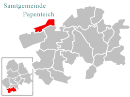
Location of Rolfsbüttel in the joint municipality of Papenteich
|
|
Rolfsbüttel is a district of the municipality of Adenbüttel in Lower Saxony . The village has about 300 inhabitants and is part of the Papenteich municipality in the Gifhorn district .
geography
Geographical location
Rolfsbüttel is located roughly between the villages of Adenbüttel , Didderse and Hillerse and is administratively part of the Gifhorn district. Rolfsbüttel and the village of Adenbüttel form the municipality of Adenbüttel. The place is about three kilometers northwest of the main town. The closest medium- sized centers are Wolfsburg , Salzgitter , Wolfenbüttel , Gifhorn , Peine and Celle .
Religions
The inhabitants of Rolfsbüttel are mostly of Protestant denomination and together with the villages of Hillerse, Didderse and Neubrück form a parish .
population
The population development in historical time is documented for Rolfsbüttel independently of Adenbüttel. Since the incorporation and the establishment of the joint community in 1974, the population development for the place Rolfsbüttel has been documented by the joint community Papenteich . As of December 31, 2006, Rolfsbüttel had 290 inhabitants.
| year | Residents | year | Residents | |
|---|---|---|---|---|
| 1821 | 141 | 1950 | 321 | |
| 1871 | 157 | 1961 | 262 | |
| 1912 | 200 | 1970 | 227 | |
| 1925 | 211 | 1980 | 232 | |
| 1933 | 191 | 1990 | 244 | |
| 1939 | 183 | 2000 | 306 |
history
Rolfsbüttel was first mentioned in a document in 1274 as the “Roluesbutle” and, in terms of settlement history, belongs to the Büttel localities.
Prehistory and early history
Several archaeological finds from several excavation phases come from the immediate vicinity of Rolfsbüttel, which show that people already settled here in the Iron Age . In 1956 an urn field with several fire urn graves was found near the road in the direction of Didderse. 7 grave urns were found on an area of only 2 m² and another 15 burials without urns were found . There was also a clasp from the Iron Age, made of copper wire with seven loops on the bracket. The clasp is exhibited today in the Gifhorn Local History Museum.
Incorporation
Rolfsbüttel was incorporated into the neighboring municipality of Adenbüttel on March 1, 1974.
Economy and Infrastructure
Public facilities
- School: Until after the Second World War , Rolfsbüttel had its own small village school.
- Fire brigade and civil protection: The Rolfsbüttel volunteer fire brigade was founded in 1900.
literature
- Brandt, C. (1912): Schwülper. A piece of Lower Saxony's local history. Hildesheim, self-published
- Heinz Klose: History from the Papenteich , Meine 1983; ISBN 3-87040-029-3
- Wolfgang Meibeyer: Settlement facts about the Papenteich , series of publications by the district of Gifhorn; Gifhorn 1994
- Lower Saxony State Administration Office (Ed.): Der Landkreis Gifhorn , Bremen 1972. (The Landkreise in Gifhorn, Vol. 26. ISBN 3-87172-327-4 )
Web links
swell
- ↑ a b Papenteicher Nachrichten, issue 395 - May 2007, page 5
- ^ Brand, Renate: Papenteich in old views , Eschenbach 1995, ISBN 3-89570-057-6
- ^ Administrative history of Gifhorn up to 1939
- ^ Federal Statistical Office (ed.): Historical municipality directory for the Federal Republic of Germany. Name, border and key number changes in municipalities, counties and administrative districts from May 27, 1970 to December 31, 1982 . W. Kohlhammer GmbH, Stuttgart and Mainz 1983, ISBN 3-17-003263-1 , p. 226 .

