Rosenberg glacier
| Rosenberg glacier | ||
|---|---|---|
|
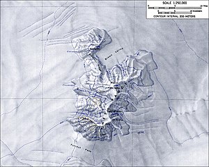
Topographic map of the Ames Range with the Rosenberg Glacier (scale 1: 250,000) |
||
| location | Marie Byrd Land , West Antarctica | |
| Mountains | Ames Range | |
| Coordinates | 75 ° 44 ′ S , 132 ° 33 ′ W | |
|
|
||
The Rosenberg Glacier is a steep and heavily furrowed glacier in the West Antarctic Marie Byrd Land . It flows in the west of the Ames Range between Mount Kosciusko and Mount Boennighausen .
The United States Geological Survey mapped it based on its own measurements and aerial photographs of the United States Navy between 1959 and 1965. The Advisory Committee on Antarctic Names named it in 1974 after Theodore J. Rosenberg, ionospheric physicist on the Siple station from 1970 to 1971.
Web links
- Rosenberg Glacier in the Geographic Names Information System of the United States Geological Survey (English)
- Rosenberg Glacier on geographic.org (English)

