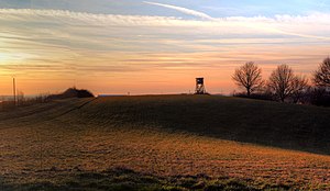
Rotenberg (North Palatinate Uplands)
| Rotenberg | ||
|---|---|---|
|
Rotenberg in the North Palatinate highlands |
||
| height | 281.5 m above sea level NHN | |
| location | near Erfenbach ; Independent city of Kaiserslautern , Rhineland-Palatinate ( Germany ) | |
| Mountains | North Palatinate Uplands | |
| Coordinates | 49 ° 29 '5 " N , 7 ° 41' 48" E | |
|
|
||
The Rotenberg is 281.5 m above sea level. NHN high elevation of the northern Palatinate mountains near Erfenbach , a district of Kaiserslautern in Rhineland-Palatinate .
Surname
The name does not come from the word red , but from the fact that the area around the elevation was cleared earlier ( Rodenberg ). The reason for the clearing was the predominantly Pleistocene , fertile loess soil there.
geography
location
The Rotenberg is located northwest of Erfenbach, southwest of Stockborn and north-northeast of Siegelbach . To the northeast, its landscape slopes down into the Lauter valley . It can be reached from Erfenbach via a circular hiking trail.
Natural allocation
The Rotenberg belongs to the natural spatial main unit group Saar-Nahe-Bergland (No. 19), in the main unit North Palatinate Bergland (193) and in the subunit Glan-Alsenz-Heights (193.1) to the natural area Untere Lauterhöhen (193.17).
Individual evidence
- ↑ a b Map service of the landscape information system of the Rhineland-Palatinate Nature Conservation Administration (LANIS map) ( notes )
- ↑ a b Siegelbach circular hiking trails, on kaiserslautern.de
- ↑ Geology and Soils ( Memento of March 4, 2008 in the Internet Archive ), on kaiserslautern.de

