Rothenbach (Elbbach)
| Rothenbach | ||
|
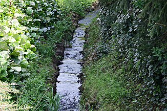
The Rothenbach in Rothenbach |
||
| Data | ||
| Water code | DE : 2587614 | |
| location |
Westerwald (natural area)
|
|
| River system | Rhine | |
| Drain over | Elbbach → Lahn → Rhine → North Sea | |
| source | in the Westerwald west of Rothenbach 50 ° 33 ′ 47 ″ N , 7 ° 52 ′ 36 ″ E |
|
| Source height | 432 m above sea level NHN | |
| muzzle | south of Rothenbach in the Elbbach Coordinates: 50 ° 33 '44 " N , 7 ° 54' 24" E 50 ° 33 '44 " N , 7 ° 54' 24" E |
|
| Mouth height | 381 m above sea level NHN | |
| Height difference | 51 m | |
| Bottom slope | 19 ‰ | |
| length | 2.7 km | |
| Catchment area | 3.019 km² | |
The Rothenbach is an almost three kilometer long right and western tributary of the Elbbach in the Westerwald .
geography
course
The Rothenbach arises in a forest area west of Langenhahn from three source streams. After unification, it initially flows in a north-easterly direction. After leaving the forest, it makes a small arc and then moves southeast through fields and meadows. It now turns to the east and, after crossing under the mountain road, reaches the outskirts of Rothenbach . He passes the place and makes a curve, changing his direction to the south-southeast. At the Rothenbacher Mühle it finally flows into the Elbbach .
Elbbach river system
Web links
Commons : Rothenbach - Collection of images, videos and audio files
Individual evidence
- ↑ a b Map service of the landscape information system of the Rhineland-Palatinate Nature Conservation Administration (LANIS map) ( notes )
- ↑ a b GeoExplorer of the Rhineland-Palatinate Water Management Authority ( information )
