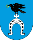
Gmina Ruda-Huta
| Gmina Ruda-Huta | ||
|---|---|---|

|
|
|
| Basic data | ||
| State : | Poland | |
| Voivodeship : | Lublin | |
| Powiat : | Chełmski | |
| Geographic location : | 51 ° 14 ' N , 23 ° 36' E | |
| Residents : | see Gmina | |
| Postal code : | 22-110 | |
| Telephone code : | (+48) 82 | |
| License plate : | LCH | |
| Gmina | ||
| Gminatype: | Rural community | |
| Gmina structure: | 15 school offices | |
| Surface: | 112.48 km² | |
| Residents: | 4520 (June 30, 2019) |
|
| Population density : | 40 inhabitants / km² | |
| Community number ( GUS ): | 0603092 | |
| administration | ||
| Address: | ul. Niepodległości 44 22-110 Ruda-Huta |
|
| Website : | www.rudahuta.pl | |
The Gmina Ruda-Huta is a rural community in the Powiat Chełmski of the Lublin Voivodeship in Poland . Its seat is the village of the same name with around 1000 inhabitants.
structure
The following 15 localities with a Schulzenamt belong to the rural community of Ruda-Huta :
- Chromówka
- Dobryłów
- Gdola
- Gotówka
- Hniszów
- Jazików
- Karolinów
- Leśniczówka
- Poczekajka
- Ruda
- Ruda Huta
- Ruda opaline
- Rudka
- Zarudnia
- Żalin
Other places in the municipality are:
- Hniszów-Kolonia
- Iłowa
- Konotopa
- Marynin
- Marysin
- Miłosław
- Ruda Kolonia
- Rudka-Kolonia
- Tarnówka
- Żalin (osada leśna)
- Żalin-Kolonia
Individual evidence
- ↑ population. Size and Structure by Territorial Division. As of June 30, 2019. Główny Urząd Statystyczny (GUS) (PDF files; 0.99 MiB), accessed December 24, 2019 .
