
Rue René Boulanger
| Rue René-Boulanger | |
|---|---|
| location | |
| Arrondissement | 10. |
| quarter | Porte-Saint-Martin |
| Beginning | 16, Place de la République |
| The End | 20, Boulevard Saint-Martin 2, Rue du Faubourg-Saint-Martin |
| morphology | |
| length | 500 m |
| width | 12 m |
| history | |
| designation | 1944 |
| Original names | Chemin de la Voirie Rue des Fossés-Saint-Martin Rue Basse-Porte-Saint-Martin Rue de Bondy |
| Coding | |
| Paris | 8128 |

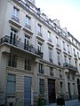
The Rue René Boulanger is a street in the neighborhood Porte Saint-Martin of the 10th arrondissement in Paris .
location
Rue René Boulanger begins at 16 Place de la République and ends after 500 meters at 20 Boulevard Saint-Martin and 2 rue du Faubourg-Saint-Martin. The 12 meter wide street also ends at the Porte Saint-Martin . In its course, it crosses Rue de Lancry, Rue Taylor, Cité Riverin and Rue Bouchardon on its northern side.
Name origin
The name he held the street on December 18, 1944 in honor of the freedom fighter René Boulanger (1901-1944). The unionist died during World War II .
history
The road has its origins in the path that ran along the hill of Saint-Martin, on the edge of the ramparts of Charles V. It was a garbage dump until 1609, which was created on the occasion of the work on the fortifications of Paris at the beginning of the 17th century was converted. After the city walls at this point were replaced by the Boulevard Saint-Martin from 1670, the path was named "Rue des Fossés-Saint-Martin". After the boulevard had been leveled (for the last time in 1851), there was a difference in height between the two lanes. The course of the road from the Porte Saint-Martin corresponds to the shape of the former bastion.
The street, which is located in the Quartier de la Porte – Saint – Martin , originally began on the Rue du Faubourg – Saint – Martin and ended at a landfill ( French voirie ), which for a while earned it the name “Chemin de la Voirie”. When the landfill was abandoned in 1758, the street was lengthened and given the name "Rue basse-Saint-Martin". In 1770 the former city wall was extended once more along the avenue to Rue du Faubourg-du-Temple and was given the name "Rue de Bondy".
In principle, the road was built between 1770 and 1840 under the Louis XVI government . and Louis-Philippe I.
Attractions
- No. 7: former home of the writer Paul de Kock
- No. 15: here lived the pianist and composer Jeanne-Hypolyte Moyroud Devismes , wife of Anne-Pierre-Jacques Devismes du Valgay
- No. 17: Theater du Petit-Saint-Martin , located on the site of the former International Mimodrama -School of Paris Marcel Marceau is
- No. 19: Bistrot Renaissance with a decoration of the Belle Époque
- No. 20: until 1860 Mairie of the former 5th arrondissement
- No. 22: former Hôtel particulier of the Marquise de Ferrières, then owned by the Marquis de Folleville, with a magnificent staircase from the 18th century. The former porcelain factory of the Duc d'Angoulême was also located here.
- No. 26: In 1870 there was a panorama , as a poster by Léon Choubrac shows.
- No. 30: Hôtel de Laguerre, a singer at the Paris Opera under Louis XVI.
- No. 32: Seat of the Marianne magazine
- No. 44: former Théâtre des Folies-Dramatiques , from 1862 to the middle of the 20th century
- No. 50/52: this is where Louis Daguerre created his first daguerreotypes
- No. 54: Hôtel d'Aligre
- No. 56: Former headquarters of Christofle , where Charles Christofle founded his company in 1842
- No. 60: the painter Georges Seurat was born here in 1859
- No. 62/64: Hôtel de Rosambo
- No. 66: Hôtel de Sechtré
- No. 68: Hôtel particulier des author and philanthropist Baron Taylor
- No. 70: picturesque private passage Villa du Lavoir
- No. 90: Hôtel Ariane
- No. 94: former cabaret from the time of Louis XIV.
Thanks to an initiative by local residents and shops, the street has been "planted", also to reduce the number of parking spaces.

Poster by Léon Choubrac for the panorama in No. 26

Hotel d'Aligre

Courtyard of the Hôtel d'Aligre

Hotel de Rosambo
Hotel de Sechtré

Rue René Boulanger


_-_panneau.jpg)
literature
- Jacques Hillairet: Dictionnaire Historique des Rues de Paris. Les Editions de Minuit , Paris 1963, ISBN 2-7073-0092-6 .
- Laure Beaumont-Maillet: Vie et histoire du Xe arrondissement . Éditions Hervas, Paris 1988, ISBN 2-903118-35-3 .
Web links
Individual evidence
- ^ Mairie de Paris: Research des rue de Paris - Rue René-Boulanger. Retrieved April 3, 2020 (French).
- ↑ A plan of the city wall as a PDF file
- ↑ Renaud Gagneux, Denis Prouvost: Sur les traces des enceintes de Paris . Ed .: Parigram. ISBN 2-84096-322-1 , pp. 108-109 .
- ↑ Pierre-Thomas-Nicolas Hurtaut: Dictionnaire historique de la ville de Paris et de ses environs . S. 398 .
- ^ Charles Gabet : Dictionnaire des artistes de l'école française, au XIXe siècle . Ed .: Madame Vergne. Paris 1831 (709 pp.).
Coordinates: 48 ° 52 ′ 8 " N , 2 ° 21 ′ 33" E