Ryder Glacier (Greenland)
| Ryder glacier | ||
|---|---|---|
|
The Ryder Glacier with its meltwater lakes (right) on a satellite photo |
||
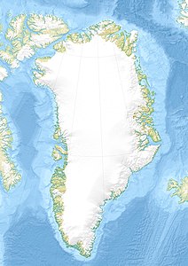
| location | Knud-Rasmussen-Land , Greenland | |
| Type | Outlet glacier | |
| length | 80 km (1990) | |
| Altitude range | 1000 m - 0 m | |
| width | Max. 20 km | |
| Coordinates | 81 ° 38 ′ N , 49 ° 10 ′ W | |
|
|
||
| drainage | Sherard Osborn Fjord → Lincolnsee | |
The Ryder Glacier is an outlet glacier in Knud-Rasmussen-Land in northern Greenland . It is named after the Danish naval officer Carl Ryder , who explored the fjord system of the Scoresbysund in 1891/92 .
The Ryder Glacier starts at the edge of the Greenland Ice Sheet at an altitude of 1000 m and has its 9 km wide glacier front more than 80 km north in the Sherard Osborn Fjord , on the west side of the Wulff Land . A second, 4 km wide western stream ends in the fjord between Permin Land and Warming Land . The last 30 km of the main stream swim as a tongue of ice on the water of the Sherard Osborn Fjord. A prominent ice ridge at the beginning of the fjord probably stems from a subglacial ridge in the bedrock. Above the ridge, the glacier forms a plateau with a very slight gradient that has numerous meltwater lakes.
The Ryder Glacier has a catchment area of 28,300 km, which is 1.7% of the area of the Greenland Ice Sheet. Its average flow rate is around 500 meters per year. In the past, the glacier has calved numerous icebergs , many of which are over 5 km long and whose drift can be followed over decades.
Between 1917, when the Danish polar explorer Lauge Koch measured the glacier for the first time during the Second Thule Expedition , and in 1956 the glacier lost 75% of its ice tongue. It has been expanding again since 1990. This process was accelerated by a “mini surge” in the fall of 1995 when the Ryder Glacier more than tripled its speed for seven weeks. In the period from 2000 to 2010, the area of the glacier increased by 4.6 km².
literature
- Anthony K. Higgins: North Greenland Glacier Velocities and Calf Ice Production (3.46 MB). In: Polar Research . Volume 60, No. 1, 1990 (published 1991), pp. 1–23 (English)
Web links
- Ryder Glacier on geographic.org (English)
- Map of the Ryder Glacier ( Memento from February 22, 2017 in the Internet Archive )
Individual evidence
- ↑ a b c Ian Joughin, Slawek Tulaczyk, Mark Fahnestock, Ron Kwok: A Mini-Surge on the Ryder Glacier, Greenland, Observed by Satellite Radar Interferometry . In: Science . Volume 274, October 11, 1996, pp. 228-230.
- ↑ a b Mauri Pelto: Ryder Glacier, Northern Greenland Transient snowline rise , accessed on February 20, 2017 (English).
- ↑ E. Rignot, S. Gogineni, I. Joughin, WB Krabill: Contribution to the glaciology of northern Greenland from satellite radar interferometry (PDF; 6.41 MB). In: Journal of Geophysical Research . 106 (D24), 2001, pp. 34007-34019 (English). doi : 10.1029 / 2001JD900071 .


