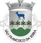
Sao Francisco da Serra
| Sao Francisco da Serra | ||||||
|---|---|---|---|---|---|---|
|
||||||
| Basic data | ||||||
| Region : | Alentejo | |||||
| Sub-region : | Alentejo Littoral | |||||
| District : | Setubal | |||||
| Concelho : | Santiago do Cacém | |||||
| Coordinates : | 38 ° 6 ′ N , 8 ° 40 ′ W | |||||
| Residents: | 809 (as of June 30, 2011) | |||||
| Surface: | 51.38 km² (as of January 1, 2010) | |||||
| Population density : | 16 inhabitants per km² | |||||
São Francisco da Serra is a municipality on the Atlantic coast of the Alentejo Litoral in Portugal . It is part of the administrative district (concelho) of Santiago do Cacém .
São Francisco da Serra consists of the towns of Cruz de João Mendes, Foros da Palhota, Roncão and São Francisco da Serra. The municipality covers a total area of 51.4 km², with a population of 809 inhabitants (as of June 30, 2011). It is a rural, mountainous area in the middle of a coastal landscape that has hardly been developed for tourism. In addition to a cork factory, there is a historic church and some old windmills in the community.
The foundation of the parish goes back to the medieval period of the Order of Santiago. The first human settlements have existed since the Bronze Age when the Celts and Phoenicians settled this area. Numerous excavations and finds that can be seen in the State Museum of Santiago do Cacém attest to this.
António Chainho was born here, a well-known composer and master of the Portuguese guitar .
Individual evidence
- ↑ www.ine.pt - indicator resident population by place of residence and sex; Decennial in the database of the Instituto Nacional de Estatística
- ↑ Overview of code assignments from Freguesias on epp.eurostat.ec.europa.eu
Web links
- Map of the Freguesia São Francisco da Serra at the Instituto Geográfico do Exército


