
Ermidas-Sado
| Ermidas-Sado | ||||||
|---|---|---|---|---|---|---|
|
||||||
| Basic data | ||||||
| Region : | Alentejo | |||||
| Sub-region : | Alentejo Littoral | |||||
| District : | Setubal | |||||
| Concelho : | Santiago do Cacém | |||||
| Coordinates : | 38 ° 0 ′ N , 8 ° 25 ′ W | |||||
| Residents: | 2020 (as of June 30, 2011) | |||||
| Surface: | 82.4 km² (as of January 1, 2010) | |||||
| Population density : | 25 inhabitants per km² | |||||


Ermidas-Sado is a Portuguese municipality in the district of Santiago do Cacém , with an area of 82.4 km² and 2020 inhabitants (as of June 30, 2011). The population density is 24.5 inhabitants per km². Ermidas-Sado received its town charter on July 12, 2001. In Ermidas-Sado there has been a train station since 1915, which acts as a transport hub in the southern Alentejo. Here the railway line divides into the Algarve Linha do Sul and the industrial center of Sines Linha de Sines , which is becoming increasingly important due to the expansion of its seaport. Ermidas-Sado is an agricultural center. There is a grain mill with a silo that receives supplies from estates in the entire area.
Individual evidence
- ↑ www.ine.pt - indicator resident population by place of residence and sex; Decennial in the database of the Instituto Nacional de Estatística
- ↑ Overview of code assignments from Freguesias on epp.eurostat.ec.europa.eu
Web links
- Map of the Freguesia Ermidas-Sado at the Instituto Geográfico do Exército
- Information from the city of Ermidas-Sado (Portuguese)
- RailFanEurope.net shows pictures of the train station in Ermidas-Sado
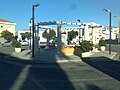
Place of the fountain

Fountain

Main church

Ermidas-Sado train station


