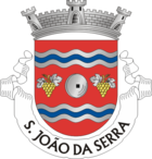
Sao João da Serra (Oliveira de Frades)
| São João da Serra | ||||||
|---|---|---|---|---|---|---|
|
||||||
| Basic data | ||||||
| Region : | Centro | |||||
| Sub-region : | Dão-Lafoes | |||||
| District : | Viseu | |||||
| Concelho : | Oliveira de Frades | |||||
| Coordinates : | 40 ° 47 ′ N , 8 ° 15 ′ W | |||||
| Residents: | 524 (as of June 30, 2011) | |||||
| Surface: | 12.41 km² (as of January 1, 2010) | |||||
| Population density : | 42 inhabitants per km² | |||||
| Postal code : | 3680-264 | |||||
| politics | ||||||
| Mayor : | Armando José Carreiro Ferreira ( PSD ) | |||||
| Address of the municipal administration: | Junta de Freguesia de São João da Serra St.ª Cruz da Tapada 3680-264 São João da Serra |
|||||
São João da Serra is a municipality ( freguesia ) in the Portuguese district ( concelho ) of Oliveira de Frades . It has 524 inhabitants (as of June 30, 2011).
history
Presumably the area was inhabited since prehistoric times, like the whole of today's district area. Parts of a Roman road from Roman times have been preserved.
The now independent municipality belonged to the municipality of Sejães until the 18th century .
Attractions
There are three religious buildings in the parish , including the parish church Igreja Matriz de São João da Serra (also Igreja de São João Baptista ) from the 18th century.
administration
São João da Serra is the seat of a municipality of the same name ( Freguesia ). The following places are in the municipality:
- Bispeira
- Carvalh
- Cercalhalva
- Conlela
- Covelinho
- Muro
- Portelinhos
- Sao Joane
- São João da Serra
Web links
Individual evidence
- ↑ a b www.ine.pt - indicator resident population by place of residence and sex; Decennial in the database of the Instituto Nacional de Estatística
- ↑ Overview of code assignments from Freguesias on epp.eurostat.ec.europa.eu
- ^ History of the parish on the district website , accessed July 7, 2013
- ↑ www.monumentos.pt , accessed on July 7, 2013


