Samson (island)
| Samson | ||
|---|---|---|
| Samson (2007) | ||
| Waters | Celtic sea | |
| Archipelago | Isles of Scilly | |
| Geographical location | 49 ° 56 '2 " N , 6 ° 21' 12" W | |
|
|
||
| surface | 38 ha | |
| Residents | uninhabited | |
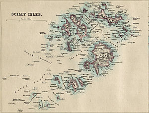
| Isles of Scilly on historical map from 1874 | ||
Samson ( Cornish Ynys Samson ) is an uninhabited island of the Isles of Scilly off the coast of Cornwall . The appearance of the approximately 0.38 km² large island is largely determined by the two hills North Hill and South Hill . The two hills resemble the Paps of Jura on the island of Jura in Scotland and the Paps of Dana (or Anu ) in County Kerry in Ireland .
The round mounds of the tumuli ( called Entrance Graves here ) on Samson are surrounded by stone surrounds. The rectangular chambers consist of megaliths with intermediate masonry . The ceilings are formed by large overhanging panels. The entrances point in different directions, but mostly to the east. The most extraordinary system on Samson consists of two chambers that are located in an irregularly shaped hill.
In 1855, Lord Proprietor A. Smith evacuated the last two families on the island to establish a deer park. However, the settlement of the wildlife was unsuccessful as all animals were able to escape from the island. Tourists can visit the ruins of the former houses of the last residents and explore the protected, unique flora and fauna.
literature
- Rita Tregella's Pope: Cornwall and the Isles of Scilly. 11th edition, Landmark, Ashbourne 2009, ISBN 978-1-8430-6440-4 (English).


