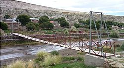
San Agustin (Potosi)
| San Agustin | ||
|---|---|---|
 San Agustin |
||
| Basic data | ||
| Residents (state) | 639 pop. (2012 census) | |
| height | 3837 m | |
| Post Code | 05-1601-0100-1001 | |
| Telephone code | (+591) | |
| Coordinates | 21 ° 9 ′ S , 67 ° 41 ′ W | |
|
|
||
| politics | ||
| Department | Potosí | |
| province | Enrique Baldivieso Province | |
| climate | ||
 Climate diagram Colcha "K" |
||
San Agustín is a town in the Potosí department in the highlands of the South American Andean state of Bolivia .
Location in the vicinity
San Agustín is the administrative seat of the province of Enrique Baldivieso and the central place of the district ( Bolivian : Municipio ) San Agustín . The village is located at an altitude of 3837 m on the northern edge of the stratovolcano Cerro San Agustín , which reaches an altitude of 5,357 m. In a north-easterly direction flows past the village of the Río Turuncha , which flows into the Laguna Turuncha ten kilometers below San Agustín.
geography
San Agustín lies on the Bolivian Altiplano between the Andes mountain ranges of the Cordillera Occidental in the west and the Cordillera de Lípez in the southeast.
Significant precipitation falls only in the months of January to March (see climate diagram Colcha "K"), the remaining nine months of the year are arid , the total precipitation in the region does not reach 100 mm per year. The annual average temperature is just under 7 ° C, the monthly values fluctuate only insignificantly between 2 ° C in June / July and 9 ° C from November to March, although nocturnal frosts are possible throughout the year.
traffic
San Agustín is located at a distance of 380 kilometers by road southwest of Potosí , the capital of the department of the same name.
From Potosí, the Ruta 5 trunk road leads 198 kilometers in a south-westerly direction to Uyuni , which is located on the Salar de Uyuni . South of Uyuni, a dirt road continues in a south-westerly direction via San Cristóbal and after 145 kilometers it reaches Alota . Two kilometers behind Alota, a track branches off to the north, which reaches San Agustín after 35 kilometers . The place is approached in a seven-hour drive once a week by a bus from Uyuni.
population
The population of the village has increased by around a third in the past two decades:
| year | Residents | source |
|---|---|---|
| 1992 | 475 | census |
| 2001 | 533 | census |
| 2012 | 639 | census |
Due to the historically grown population distribution, the region has a high proportion of Quechua population, in the municipality of San Agustín 95.5 percent of the population speak the Quechua language.
Some of the women work as migrant workers in northern Chile , but for some years the population has been receiving an additional income from collecting wild herbs as part of the Global Environment Facility (GEF) development program.
Individual evidence
- ^ INE - Instituto Nacional de Estadística Bolivia 1992
- ^ INE - Instituto Nacional de Estadística Bolivia 2001
- ↑ INE - Instituto Nacional de Estadística Bolivia 2012 ( Memento of the original from July 22, 2011 in the Internet Archive ) Info: The archive link has been inserted automatically and has not yet been checked. Please check the original and archive link according to the instructions and then remove this notice.
- ↑ INE social data 2001 (PDF; 5.5 MB)
Web links
- Relief map of the Cerro Araral region 1: 250,000 (PDF; 9.85 MB)
- Municipio San Agustín - general maps No. 51601
- Municipio San Agustín - detailed map and population data (PDF; 708 kB) ( Spanish )
- Department Potosí - social data of the municipalities (PDF; 5.23 MB) ( Spanish )
- UNDP in Action: Bolivia (English) (PDF file; 107 kB)
