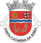
Santa Catarina da Serra
| Santa Catarina da Serra | ||||||
|---|---|---|---|---|---|---|
|
||||||
| Basic data | ||||||
| Region : | Centro | |||||
| Sub-region : | Region of Leiria | |||||
| District : | Leiria | |||||
| Concelho : | Leiria | |||||
| Coordinates : | 39 ° 40 ′ N , 8 ° 41 ′ W | |||||
| Residents: | 4089 (as of June 30, 2011) | |||||
| Surface: | 35.78 km² (as of January 1, 2010) | |||||
| Population density : | 114 inhabitants per km² | |||||
| politics | ||||||
| Mayor : | Joaquim Pinheiro Laíns de Oliveira | |||||
| Address of the municipal administration: | Junta de Freguesia de Santa Catarina da Serra Rua Santa Catarina, Nº22 2495-186 Santa Catarina da Serra |
|||||
| Website: | www.santacatarinadaserra.com | |||||
Santa Catarina da Serra is a Portuguese municipality in the district of Leiria . The area is 35.8 km² with 4089 inhabitants (as of June 30, 2011). The population density is: 114 inhabitants / km².
geography
The place is located in the extreme southeast of the Leiria district, not far from the pilgrimage site of Fátima to the south .
history
The community was founded in 1549 as an amalgamation of smaller settlements in the area. On April 2, 2001, the place was raised to Vila (small town).
administration
The following localities are located in the municipality: Loureira, Magueigia, Ulmeiro, Quinta da Sardinha, Pedrome, Santa Catarina da Serra, Pinheiria, Gordaria, Donairia, Barreiria, Cercal, Quinta do Salgueiro, Casal das Figueiras, Vale Maior, Olivais, Vale Sumo, Sobral, Sobral da Granja, Vale Faria, Sete Rios, Vale Tacão, Siróis, Cova Alta, Casal da Estortiga, and Casal da Fonte da Pedra.
economy
The most important employer is the industry , with its numerous companies in wood, cork , stone and metal processing, furniture manufacturing and the like. a. Agriculture continues to have some importance.
traffic
The municipality is located on the A1 motorway , between the Fatima and Leiria exits.
The municipality does not have its own railway connection, the nearest train stations are the Fáitima and Ourém / Seiça, the Linha do Norte, about 20 km away .
Individual evidence
- ↑ www.ine.pt - indicator resident population by place of residence and sex; Decennial in the database of the Instituto Nacional de Estatística
- ↑ Overview of code assignments from Freguesias on epp.eurostat.ec.europa.eu


