Sassafras (Victoria)
| Sassafras | |||||||
|---|---|---|---|---|---|---|---|
 The Sassafras settlement |
|||||||
|
|||||||
|
|||||||
|
|||||||
|
|||||||
|
|
|||||||
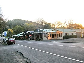
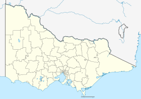
Sassafras is an eastern suburb of Melbourne in the south of the Australian state of Victoria . The place is on the ridge line of the Dandenongs at about 500 m height, about 43 km from the city center of Melbourne. It belongs to the Yarra Ranges Shire Local Government Area . At the 2016 census, Sassafras had 1,061 inhabitants. Only a few kilometers north of the village is the highest point of the Dandenongs, Mount Dandenong .
history
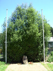
The area was named Sassafras Gully after the trees ( atherosperma ) found there. In 1893 the land was made available to smallholders and a small settlement developed. The first post office opened there on June 1st, 1901 and was always called Sassafras Gully Post Office . At the beginning of the 20th century tourism increased and the settlement grew with it.
today
Today Sassafras is a destination with many shops and boutiques, such as B. Cream tea bars , antique shops and flower growers . There is an alternative school in Sassafras , the Sherbrooks Community School .
There are many forest fires in the area and the areas around the settlement have burned down repeatedly since the 1850s.
Watercourses
Sassafras lies between the catchment areas of the Yarra River and Dandenong Creek . The Sassafras Creek is located east of the settlement, while tributaries of the Dandenong Creek north and west are the settlement. Both streams have important habitats, most of which are part of the Dandenong Ranges National Park .
The Sassafras Creek flows into the Woori Yallock Creek , which in turn flows into the Yarra River at the Warramate Nature Conservation Reserve , a state reserve. The floodplain of Sassafras Creek is almost entirely public property that belongs to the national park.
Dandenong Creek flows directly into Port Phillip at Patterson Lakes . In some maps, its lower reaches are also referred to as the Patterson River . In this area, the Dandenong Creek is channeled a few kilometers.
flora
Sassafras has a rich exotic flora, especially because of the fertile volcanic soil. Exotic flowers, including weeds, also grow on most private properties.
Web links
Individual evidence
- ↑ a b Australian Bureau of Statistics : Sassafras ( English ) In: 2016 Census QuickStats . June 27, 2017. Retrieved April 20, 2020.
- ^ Premier Postal History: Post Office List . Retrieved April 11, 2008.
- ↑ Wildfire History in the Dandenong Ranges . Olinda Rural Volunteer Fire Brigade. Retrieved on January 18, 2008 ( page no longer available , search in web archives ) Info: The link was automatically marked as defective. Please check the link according to the instructions and then remove this notice.

