
Altmannsdorf pumping station
The pumping station in Altmannsdorf in the 12th district of Vienna , Meidling , was a hoist that supplied water to an ice works .
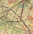
- Historical maps of the "pumping station"

1872: Ice works near Altmannsdorf, dark green areas mean gardens

1901: Ice works near Altmannsdorf (bottom right)
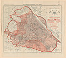
1902: Vienna water supply: No pumping or lifting works in Altmannsdorf
1905: City of Vienna traffic plan


The two municipal settlements " Am Schöpfwerk " take their name from this water supply system.
Ice works
The ice works existed from the middle of the 18th century; Ice blocks were produced in it in winter, which were used to cool cellars, but also as a coolant in the predecessors of refrigerators, the ice boxes .
Shallow lakes were created to produce ice, the water of which froze to ice in the winter frost. This ice cream was cut into blocks, stored in cellars, and sold during the warmer seasons. Areas of the later settlement area were also used for these lakes. The water for the ice production was taken from a series of wells and a small stream that flowed openly through Altmannsdorf and then past the ice works into the open area (along the Inzersdorfer Weg , the road from Altmannsdorf to Inzersdorf, officially named Am Schöpfwerk in 1912 ; see the historical one Map 1872).
The map from 1872 (see pictures) shows that the areas of the ice plant were used as vegetable beds or gardens in the warmer seasons and that the system also served as an irrigation system for vegetable beds .
In 1890/92 the area was incorporated into the City of Vienna. Around 1900 the ice ponds were no longer visible on the city map. The street name “An den Eisteichen”, officially established in 1912, is a reminder of them.
The alleged lack of stability of the former pond area was given in 1980 as the reason for the slight sinking of a higher block of flats in the new part of the “Am Schöpfwerk” residential complex.
No pumping station in the high spring pipeline
Name interpretations according to which the pumping station derives its name from a pumping or pumping station of the 1st Viennese high spring water pipeline do not apply. There is no evidence of a water pipe pumping station near Altmannsdorf in contemporary literature, and no maps show it. The aqueduct is a conduit for spring water from the Rax and Schneeberg areas , which, due to its natural gradient (gravitational pipeline ), does not require any pumping stations to transport water from the south of Lower Austria to Vienna. Altmannsdorf was in an area that did not require any technical assistance from the high spring water supply. The first high spring water pipeline was built in the years before 1873. Your first water tank was built away from Altmannsdorf at the end of the line on the Rosenhügel , about 50 meters higher than Altmannsdorf. Contemporary and more recent literature mention a number of technical facilities of this water pipe, such as (for an additional water supply, not for the pipe itself) the pumping station in Pottschach and lifting works in Breitensee or on the Schafberg and on the Wienerberg in Favoriten , but no pumping station in Altmannsdorf. The introduction of groundwater into the Viennese water supply network was considered, but with water from the Danube Valley, the Mitterndorfer Senke or the Fischa-Dagnitz spring, not from the Altmannsdorf area or anywhere else from the Liesing catchment area . Another aqueduct of the time in Vienna, the Wientalwasserleitung had 31 pumping stations, but did not deliver any water to Altmannsdorf. In addition, this place was only connected to Vienna's water network in 1910. A pumping or pumping station, which supposedly should have been built around 1870/71 or 1870–73, would not have been able to feed its water into the Vienna pipeline network. That as the first pumping station in the network of the Vienna water supply called pumping station Breitensee was not built until 1892-96. There were other pumping stations, such as Vienna's 66 well pumping stations for wetting the traffic areas, but none in Altmannsdorf. The water tower in Favoriten was built later, in 1899, and closed again in 1910. He had his own pumping system connected to him with steam engines and plunger pumps. This plant was not in Altmannsdorf. A water tank is located in the east of Altmannsdorf further away on the Laaerberg and there is no mention of a connection to the Altmannsdorf area.
Individual evidence
- ↑ Peter Haldovsky: Altmannsdorf (1138 to 1983). Becoming a suburban church. 1st volume, with the assistance of the editorial team of the magazine "Die Brücke". Parish Altmannsdorf, Vienna 1983, p. 90.
- ↑ Peter Haldovsky: Altmannsdorf (1138-1989). Becoming a suburban church. 2nd volume, published on the occasion of the 150th anniversary of the parish church Altmannsdorf-St. Oswald am Khleslplatz with the help of the editorial team of the parish newspaper “Die Brücke”. Parish Altmannsdorf. Vienna 1989, p. 106.
- ^ Eva Blimlinger: The emergence of an attractive suburban settlement. In: Chris Rejmann, Ferry Rodinger, Franz Eisen and others: Page no longer available , search in web archives: Festschrift 25 Years of Schöpfwerk . District Center Bassena, Association of Vienna Youth Centers, Vienna 2005, p. 32.
- ↑ Description in www.bassena.at, accessed February 3, 2011.
- ^ Anton Bina: The sinking skyscraper. In: daily newspaper Kurier. September 26, 1980, p. 6.
- ↑ The terms "pumping station" and "pumping station" are at least partly used synonymously in the older literature and do not allow any conclusions to be drawn about technical methods, for example in Paul Kortz: water supply. The Kaiser Franz Josef Hochquellen water line. In: Theodor Weyl (Ed.): The Assanierung von Wien. First volume, second volume in the series: The sanitation of cities in individual representations. Engelmann, Leipzig 1902, p. 23.
- ↑ a b At the pumping station. In: Felix Czeike : Historisches Lexikon Wien. Volume 1: A – Da. Kremayr & Scheriau / Orac, Vienna 2004 ff., ISBN 3-218-00742-9 , p. 90.
- ↑ Chris Rejmann, Ferry Rodinger, Franz Eisen a. a .: The street names around the pumping station and the surrounding area. In: Festschrift 25 years of the pumping station . District Center Bassena, Association of Vienna Youth Centers, Vienna 2005, p. 25.
- ↑ Haldovsky: Altmannsdorf. 1st volume, 1983, pp. 130 and 164.
- ↑ Josef Donner: To refresh you, my beloved Vienna. History of the Viennese water supply from the beginning to 1910. Ed .: Austrian Association for the Gas and Water Industry. Norka Verlag Dr. Norbert Kastelic, Vienna undated [1990], ISBN 3-85126-25-2 , p. 91.
- ↑ a b Paul Kortz: water supply. The Kaiser Franz Josef Hochquellen water line. In: Theodor Weyl (Ed.): The Assanierung von Wien. First volume, second volume in the series: The sanitation of cities in individual representations. Leipzig, Engelmann 1902, pp. 3, 17-25.
- ^ Alfred Drennig, Christian Fischer (technical drawings): The 1st Vienna high spring water pipeline. Festschrift. Published by the Vienna City Administration, Department 31 - Waterworks, on the occasion of the 100th anniversary on October 24, 1973. Verlag Jugend und Volk, Vienna / Munich 1973, ISBN 3-7141-6829-X .
- ↑ Donner: To refresh you ... p. 59.
- ↑ Donner: To refresh you ... p. 64.
- ↑ Donner: To refresh you ... p. 67.
- ↑ Paul Kortz: Vienna in the early 20th century. A guide in a technical and artistic direction. Published by the Austrian Association of Engineers and Architects. Volume 1, Gerlach & Wieding, Vienna 1905, pp. 225 and 227–228 (Breitensee water lift) and 228–229 (Favoriten, near the water tower).
- ↑ Rudolph Stadler: Memorandum on the opening of the high-spring water pipeline in 1873. Self-published by the Vienna City Council, Vienna 1873, pp. 73–75.
- ^ Drennig: Festschrift. P. 31.
- ^ Stadler: Memorandum. P. 75.
- ↑ Kortz: Vienna at the beginning .... P. 238 and plate XV (after p. 234).
- ↑ a b Peter Haldovsky: Altmannsdorf. Volume 2, p. 122.
- ^ Stadler: Memorandum. P.56.
- ^ Website about the water tower Favoriten ( Memento from May 18, 2015 in the Internet Archive ).
- ^ Stadler: Memorandum. Pp. 278-279.
Coordinates: 48 ° 9 ′ 42 ″ N , 16 ° 19 ′ 28 ″ E