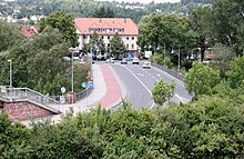
Schützenpfuhlbrücke
Coordinates: 50 ° 47 ′ 45 " N , 8 ° 45 ′ 42" E
| Schützenpfuhlbrücke | ||
|---|---|---|
| The Schützenpfuhlbrücke from the south | ||
| Official name | Schützenpfuhlbrücke | |
| use | Pedestrians and cars | |
| Convicted | At the Krekel | |
| Crossing of | Lahn | |
| Subjugated | three foot and bike paths | |
| place | Marburg | |
| construction | 5-span arch bridge | |
| overall length | 94.22 m | |
| width | 16.5 m | |
| start of building | March 1892 | |
| completion | December 1892, remodeling: November 1934 |
|
| construction time | nine months | |
| Status | Well | |
| planner | Louis Broeg | |
| toll | no | |
| location | ||
|
|
||
| Above sea level | 181 m above sea level NN | |
The Schützenpfuhlbrücke in the central Hessian city of Marburg is a five-span arch bridge made of sandstone . It crosses the Lahn near the Südbahnhof . It has a length of almost 95 m, a street width of 10.5 m for three lanes and a footpath and cycle path on the downstream side, each 2.25 m wide; on the northern side of the upstream there is only an edge cap 0.75 m wide.
Prehistory and construction
Even before the construction of the first bridge, this point was used as a ford over the Lahn. It connected the city of Marburg with its surrounding area and led in the direction of Cappel and Ebsdorfer Grund . The Schützenpfuhl (or Schützenpfuhlteich) was an old arm of the Lahn, which can no longer be seen today because it was completely filled in. It was roughly in the area of today's Konrad-Adenauer-Brücke and August-Rohde-Strasse. Due to floods, the location and extent of the Schützenpfuhl were repeatedly changed. Since there were no other road bridges between the Weidenhausen Bridge in the north and the Nehbrücke near Argenstein, calls for a pedestrian walkway were loud from 1825. It was not until 1878 that the State Director of the Prussian Province granted permission to build such a footbridge, which was to be dismantled every winter and rebuilt in spring.
From 1881 the district administrator of the then district of Marburg , Karl Schreiber, tried to have a bridge built. In 1884 the request was finally granted and a building permit was granted. The construction took place between March and December 1892. The sandstone bridge was based on a design by the city architect Louis Broeg and was 100 m long and 7.20 m wide. Five years later, the south station on the Main-Weser-Bahn was built in the immediate vicinity , which was the start and destination of the Marburg circular railway , which went into operation in 1905 . Due to the rapid development of the southern district that began around the turn of the century, the Marburg tram ran from the main train station to Wilhelmsplatz from 1904 , which was extended to Gisselberger Strasse in 1912 and over this bridge to the southern train station in 1936. Due to the relocation of trunk road 3 , which previously ran through the city center via Frankfurter Strasse, Pilgrimstein and Bahnhofstrasse, the Schützenpfuhlbrücke was to be widened in 1933. A 9 instead of 5 m wide carriageway with two 2.5 m wide pedestrian paths as well as the vaults, which had to be completely rebuilt, made the conversion into a new building. The bridge was opened to traffic again in November 1934. The bypass road, which now ran across the Lahn and roughly corresponds to the current route of the B3a, ended shortly before the confluence with Bahnhofsstraße. Around this time, the Schützenpfuhl was also filled in, so that the bridge lost its name and is therefore often only called Südbrücke or Südbahnhofsbrücke .
Changes after World War II
The Konrad-Adenauer-Brücke , which was built in 1969 in connection with the expansion of the B3a, relieved the Schützenpfuhlbrücke. Due to the increasing volume of traffic, it was decided in 1984 to implement a descent towards the south onto the Schützenpfuhlbrücke. In addition to strengthening the bridge vault, the plans also included a further widening to 16.50 m. In this way, three lanes could be realized with two 2.50 m wide footpaths and cycle paths on the downstream side. On the upstream side, a walkway was dispensed with due to the pedestrian bridge to the south station and the directly adjoining junctions on Gisselberger Straße and Am Krekel.
Today the bridge is an important pedestrian link between the Südbahnhof and Gisselberger Straße. It is also indispensable for road traffic, as the Marburg-Gisselberger Straße motorway exit is often used and the Am Krekel street connects an adjoining industrial area (where the Marburg municipal utilities are also located) with the city center.
See also
literature
- Ulrich Hussong : The Schützenpfuhl Bridge. Rathaus-Verlag, Marburg 1993 (Marburger Stadtschriften zur Geschichte und Kultur 44).
- Hans Günther Bickert / Norbert Nail: The inn on the Lahn: The legendary "Gasthof zum Schützenpfuhl" in Marburg and its guests. With an article about "Letters of Heaven". Marburg: Büchner-Verlag 2019 ISBN 978-3-96317-166-6
Web links
Individual evidence
- ^ City of Marburg (ed.): 75 years of urban local transport. Marburg 1986.


