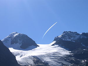
Snow bell (Silvretta)
| Snowbell | ||
|---|---|---|
|
Snowbell from the northwest |
||
| height | 3223 m above sea level A. | |
| location | Vorarlberg , Austria | |
| Mountains | Silvretta | |
| Dominance | 0.9 km → Silvrettahorn | |
| Notch height | 83 m ↓ Silvretta gap | |
| Coordinates | 46 ° 51 '52 " N , 10 ° 5' 8" E | |
|
|
||
| rock | Amphibolite , hornblende gneiss | |
The snow bell is a 3223 m above sea level. A. high, glaciated mountain peaks of the Silvretta group in the Eastern Alps . The mountain is located in the Montafon in the state of Vorarlberg . In the west of the summit is the Klostertal Glacier , in the east the Snow Bell Glacier . The snow bell is the highest peak that lies entirely in Vorarlberg.
The neighboring peaks include the Silvrettahorn ( 3244 m ) in the southeast, the knot ( 3190 m ) in the south, the Rothfluh ( 3166 m above sea level ) in the southwest and the Schattenspitze ( 3202 m ) in the north.
Members of the Saarbrücken Section erected the metal summit cross in 1960.
The normal route leads through the Klostertal , with the Silvretta reservoir as the starting point. You can also start at the reservoir for a ski tour . After the reservoir, head towards the Klostertaler Umwelthütte , then continue into the Klostertal and at an altitude of around 2400 meters, head east on the Klostertal glacier towards the summit.
Web links
Individual evidence
- ↑ Alpine Club Card 26 Silvretta / Silvretta Group (1: 25,000). ISBN 978-3-9287-7735-3 .
- ↑ https://www.bergfreunde-saar.de/fileadmin/user_upload/gruppen/Schneeglocke/Schneeglocke.pdf
- ↑ Through the Klostertal to the snow bell . alpintouren.com, Retrieved May 12, 2010.


