Shuja (Logmosero)
|
Shuja Шуя, Suojoki |
||
|
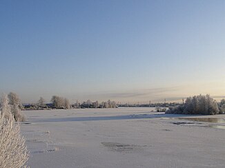
Shuja in winter |
||
| Data | ||
| Water code | RU : 01040100112102000014042 | |
| location | Republic of Karelia ( Russia ) | |
| River system | Neva | |
| Drain over | Swir → Neva → Baltic Sea | |
| origin |
Suojarwi 62 ° 13 ′ 51 ″ N , 32 ° 27 ′ 29 ″ E |
|
| Source height | 137 m | |
| muzzle | north of Petrozavodsk in the Logmosero ( Onega Lake ) Coordinates: 61 ° 52 ′ 43 " N , 34 ° 17 ′ 47" E 61 ° 52 ′ 43 " N , 34 ° 17 ′ 47" E |
|
| Mouth height | 33 m | |
| Height difference | 104 m | |
| Bottom slope | 0.54 ‰ | |
| length | 194 km | |
| Catchment area | 10,100 km² | |
| Drainage location: 11 km above the mouth |
MQ |
90.2 m³ / s |
| Drain |
MQ |
130 m³ / s |
| Left tributaries | Sjanga | |
| Flowing lakes | Schotosero , Wagatosero | |
|
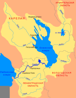
Course of the Shuja (Шуя) in the catchment area of the Swir |
||
The Shuja ( Russian Шуя ; Finnish Suojoki ) is a river in the Republic of Karelia in northwestern Russia .
The 194 km long river has its origin in Lake Suojarwi . From there it flows in a southerly direction, later it turns to the east and flows north of Petrozavodsk into the Logmosero and into the Onega Sea . About half way the Schuja flows through the two lakes Schotosero and Wagatosero . The Sjanga , the outflow from the Lake Sjamosero, flows into the latter .
Web links
- Makeaa vettä petroskoilaisille (russ.)

