Schwarzburgstrasse
| Schwarzburgstrasse | |
|---|---|
| Street in Frankfurt am Main | |
|
|
|
| Basic data | |
| place | Frankfurt am Main |
| District | Northrend-West |
| Created | after 1850 |
| Cross streets | Oeder Weg , Eckenheimer Landstrasse , Friedberger Landstrasse |
| Buildings | Schwarzburg School, Explora, City Gate |
| Technical specifications | |
| Street length | approx. 700 meters |
The Black Castle Street is a residential street in Northrend from Frankfurt .
course
Schwarzburgstraße runs in a west-east direction between Oeder Weg and Friedberger Landstraße . At its westernmost point, it encounters the historical enclosure of the Holzhausen Park, which is still evidenced by a green island (Paul Hindemith enclosure) and the historic entrance gate of the park. At this point the park was withdrawn by around 200 meters in favor of development. In the east, Schwarzburgstrasse meets Friedberger Landstrasse, just south of its intersection with Frankfurter Alleenring .
Surname
The Schwarzburgstrasse is named after Günther von Schwarzburg , who in turn derived his name from the Schwarzburg . He was elected on January 30, 1349 by the supporters of the Wittelsbach party in the Dominican monastery in Frankfurt as the anti-king of Karl IV from Luxembourg . He derived his legitimacy expressly from the fact that his election, unlike Karl's in Frankfurt, was “in the right place” for a king's election.
After his supporters were defeated by Charles's troops near Eltville , Günther waived his claims in exchange for a high severance payment and, already seriously ill, retired to Frankfurt, where he died on June 14, 1349 in the Johanniterkloster . He was the only German king to be buried in Frankfurt. His grave is in the high choir of the imperial cathedral St. Bartholomäus .
meaning
The Schwarzburgstrasse is, like the Glauburgstrasse running south , an east-west connection in the north end. In order to protect residents from traffic noise, it is divided into opposing sections of one-way streets for drivers . However, bicycle traffic is open for both directions of travel.
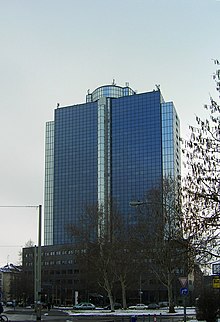
At the beginning of the street is the City Gate (formerly Büro Center Nibelungenplatz and Shell high-rise). As a skyscraper, the building is completely foreign to the district and the street. In terms of planning, it is the remainder of a development plan that provided for the entire northern Frankfurter Alleenring to be converted into an expressway and high-rise buildings to be erected at all important intersections. The plan was not pursued any further.
In the middle of the eastern arm of Schwarzburgstrasse is the Explora , a private "science and technology museum" in a former bomb shelter from the Second World War . Here, three-dimensional images are exhibited using various techniques. Access is via Glauburgplatz, located on Glauburgstrasse .
To the west at the intersection with Lenaustraße is the Schwarzburgschule , a primary school for the surrounding residential area.
In the street, some remarkable historicist façades of the residential buildings survived the air raids on Frankfurt am Main in World War II , including one - very rare in Frankfurt - in “English” “Tudor Gothic” (corner of Spohrstraße).
Individual evidence
- ↑ Stadtvermessungsamt Frankfurt am Main (ed.): Portal GeoInfo Frankfurt , city map
- ↑ Rita Henss: Where is the castle? In: NORDend 1 (2010), p. 66.
Web links
Coordinates: 50 ° 7 ′ 39.9 ″ N , 8 ° 41 ′ 16.2 ″ E

