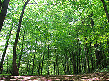
Swords forest

The Schwerter Forest is an extensive forest area and local recreation area between the Ruhr area cities of Schwerte and Dortmund . The forest area is located south of the Dortmund district of Aplerbeck on a ridge of the Ardey Mountains and north of the Schwerte exit on the A 1 on both sides of the B 236 . The forest area connected with the Aplerbeck forest is - from northeast to southwest - about 3.6 km long and a maximum of 2 km wide.
The forest area is sponsored by the Ruhr Regional Association .
The forest is crossed by the federal highway 236. At its apex and the transition to the Ruhr valley is the Freischütz excursion restaurant . This goes back to a forester's house that was built in 1843, which was allowed to serve alcohol in 1861 and quickly developed into a popular excursion destination for the Dortmund and Schwerter population. The popularity of the Schwerter Wald increased further when a tram line was opened in 1899. This was shut down on April 1, 1971.
During the construction of the Dortmund – Schwerte railway line, the establishment of a Schwerte Wald stop was considered. However, this project failed due to a lack of funding. In the western part of the Schwerter Forest in the city of Schwerter is the Schwerte telecommunications tower , a 158 meter high type tower of the former German Federal Post Office.
There are burial mounds in Dortmund area, which are entered as ground monuments in the list of monuments of the city of Dortmund .
In the southern area of the Schwerter Wald there is the Catholic Academy Schwerte , a supraregional training center of the Archdiocese of Paderborn .
Individual evidence
- ↑ http://as.schwerte.de/expenses/html/as46/text/002-99r.html
- ↑ No. B 0004. List of monuments of the city of Dortmund. (PDF) (No longer available online.) In: dortmund.de - Das Dortmunder Stadtportal. Monument Authority of the City of Dortmund, April 14, 2014, archived from the original on September 15, 2014 ; accessed on June 16, 2014 (180 kB). Info: The archive link was inserted automatically and has not yet been checked. Please check the original and archive link according to the instructions and then remove this notice.
Coordinates: 51 ° 27 ′ 54 ″ N , 7 ° 33 ′ 16 ″ E

