
Selianitika
|
Local community Selianitika Τοπική Κοινότητα Σελιανιτίκων (Σελιανίτικα) |
|||
|---|---|---|---|
|
|||
| Basic data | |||
| Country |
|
||
| region | West Greece | ||
| Regional district | Achaia | ||
| local community | Egialia | ||
| Parish | Symbolitia | ||
| Geographic coordinates | 38 ° 16 ' N , 22 ° 1' E | ||
| Height above d. M. |
5 m (average) |
||
| surface | 2.975 km² | ||
| Residents | 902 (2011) | ||
| Population density | 304.87 inhabitants / km² | ||
| LAU-1 code no. | 37020615 | ||
| Local division | 1 | ||

Selianitika ( Greek Σελιανίτικα ( n. Pl. )) Is a village in the municipality of Symbolitia in the municipality of Egialia in Greece. It is located on the north coast of the Peloponnese on the Gulf of Corinth , about 7 km west of Egio and 30 km east of Patras . Selianitika has 907 inhabitants (as of 2011).
Selianitika and its neighboring town Longos are connected by an approximately 1.5 km long beach. Both places are popular excursion destinations during the summer months.
Geographical location and climate
The village is located on the Gulf of Corinth in beautiful surroundings with vineyards, olive and citrus trees. The nearest town to the east is Egion, 7 km away. Patras, the third largest city in Greece and the administrative center of Achaea, is about 30 to 35 km away.
The center of Selianitika is about 30 m above sea level. The place has an extensive beach with fine gravel, as is often found on the Gulf of Corinth. The beach extends to the neighboring town of Longos and is known for its clean, blue shining water.
On the beach you have a good view of the Klokos Mountains to the south, Panachaiko in the southwest and over the Gulf of Corinth to the Fokida Mountains in the north.
The region's climate is pleasantly Mediterranean with mild winters and moderately hot summers.
traffic
Apart from the old national road ( Greek Παλαιά Εθνική Οδός Palea Ethniki Odos ) GR-8 , which connects the place with Egion, Patras and the neighboring villages, Selianitika also has a connection to the so-called new national road (Greek Nea Ethniki Odos Νέα Εθνική Οδός ) ( GR-8A , Athens- Corinth-Patras).
An exit for Selianitika / Longos is planned for the new Elefsina – Korinth – Patras – Tsakona motorway as an upgrade of the GR-8A national road to motorway standard; construction is expected to start in 2009.
Infrastructure
There is a primary school in Selianitika, the next secondary school and a high school are in Erineos and Egio. On the village square ( Platia ) is the central church of Saint Basil , an ATM of the Greek National Bank, a supermarket and small shops, a newsagents with international newspapers, bakeries and a candy shop. There is also a pharmacy and an English-speaking country doctor (agrotikos iatros) .
The nearest hospital is in Egio ; Patras University Hospital, one of the largest hospitals in Greece, is just 25 km away.
Patras-Araxos Airport is approximately 65 km to the west. There are flights to it from the German airports of Hanover, Düsseldorf and Frankfurt am Main in the summer months from May to September.
tourism
For many Greeks, especially those from Athens and Patras, Selianitika is a summer resort. There are hotels, guest houses and several restaurants along the beach promenade. More entertaining nightlife can be found after a ten-minute stroll on the beach in Longos or on Rododafni beach; Akoli can be reached in five minutes by car.
Mineral springs have been found in Selianitika and there is a small balneological spa.
The Hellenikon Idyllion (Greek Ἑλληνικόν Εἰδύλλιον), also known as the Garden of the Muses, is a musical and cultural meeting place and at the same time a holiday accommodation in Selianitika. Every year, mostly in the summer months, the Hellenikon Idyllion organizes concerts and competitions on the ancient Greek language and classical music.

Selianitika on the Gulf of Corinth on a sunny winter day (January 2008)
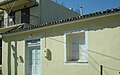
Selianitika medicinal bath
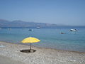
Selianitika beach

Panorama of Selianitika and Longos


Population development
| year | Residents | modification | Share in the total municipality in% | Settlement density |
|---|---|---|---|---|
| 1981 | 814 | - | - | 290.71 / km² |
| 1991 | 997 | +183 / +22.48% | - | 356.07 / km² |
| 2001 | 1,147 | +150 / +15.05% | 14.63% | 409.64 / km² |
literature
- Αθ. Φωτόπουλος: Ιστορικά και Λαογραφικά της Ανατολικής Αιγιάλειας και Καλαβρύτων. Athens 1982 (Greek)
- K. Baedeker: Greece - Handbook for Travelers . Leipzig 1893
Web links
- Cultural Association of Selianitika "Helios" (Greek)
- Official website of the Municipality of Sympoliteia (Greek)
- The municipality of Sympolitia
- Information from the Greek Travel Pages
Individual evidence
- ↑ a b Results of the 2011 census. ( Memento from June 27, 2015 in the Internet Archive ) ( MS Excel ; 2.6 MB) National Statistical Service of Greece (ΕΛ.ΣΤΑΤ)
- ↑ Concession contract for the construction of the Athens-Corinth-Patras-Pyrgos-Tsakona motorway ( memento of the original from October 24, 2007 in the Internet Archive ) Info: The archive link was automatically inserted and not yet checked. Please check the original and archive link according to the instructions and then remove this notice. (PDF) VINCI press release of February 5, 2007
- ↑ Olympia Odos Autobahn Project. ( Memento of the original from September 18, 2008 in the Internet Archive ) Info: The archive link was inserted automatically and has not yet been checked. Please check the original and archive link according to the instructions and then remove this notice. Official website
- ↑ List of Local Mineral Springs of Greece. Republic of Greece - Ministry of Tourism