Si Sa Ket
|
ศรีสะเกษ Si Sa Ket |
||
|---|---|---|
|
|
||
| Coordinates | 15 ° 7 ′ N , 104 ° 20 ′ E | |
| Symbols | ||
|
||
| Basic data | ||
| Country | Thailand | |
| Si Sa Ket | ||
| ISO 3166-2 | TH-33 | |
| Residents | 39,945 (2011) | |
| Website | www.musisaket.go.th/2010 (Thai) | |
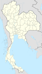
Si Sa Ket (also: Si Saket , Sisaket , Srisaket , thaiändisch ศรีสะเกษ ) is a city ( เทศบาล เมือง ศรีสะเกษ ) in the Thai province of Si Sa Ket . It is the capital of the district ( Amphoe ) Mueang Si Sa Ket and the province of Si Sa Ket.
The city of Si Sa Ket has 39,945 inhabitants (as of 2011).
geography
The province of Si Sa Ket is located in the south of the Isan , the northeast region of Thailand . The city of Si Sa Ket is located in the southern part of the Isan on the Maenam Mae Nam Mun (Mun River) , one of the tributaries of the Mekong . The distance to the capital Bangkok is around 570 kilometers.
Economy and Transport
Si Sa Ket benefits from the archaeological cultural monuments of the historical Khmer culture that are in the area and favor tourism .
It has a train station on the Nakhon Ratchasima – Ubon Ratchathani railway , an extension of the northeast railway coming from Bangkok .
history
Si Sa Ket was originally called Mueang Khu Khan ( เมือง ขุขันธ์ ) and was founded as a Khmer settlement just outside of today's urban area. In 1759 it received city rights during the Ayutthaya period. During the reign of King Chulalongkorn (Rama V) , the old city was repositioned, but still kept its name Khu Khan. It was not renamed Si Sa Ket until 1938.
Attractions
- Fields of ruins - just outside the city there are many examples of ancient Khmer complexes
- Rambutan - Durian Festival - in June, fair with sales and tasting of local fruits with parade and beauty competition
- Si Sa Ket Aquarium
Personalities
- Chumpol Bua-ngam (* 1986), football player
- Pongsak Boonthot (born 1995), football player
- Ekkapan Jandakorn (* 1986), football player
- Suradet Klankhum (* 1996), football player
- Theerachai Ngamcharoen (born 1983), football player
- Chatri Rattanawong (* 1993), football player
- Pralong Sawandee (born 1987), soccer player
- Phuwadol Suwannachart (* 1982), football player
Web links
- City map of Si Sa Ket (names in English and Thai) accessed on November 14, 2013
Individual evidence
- ↑ Department of Provincial Administration : As of 2011 (in Thai)

