Siletz River
| Siletz River | ||
|
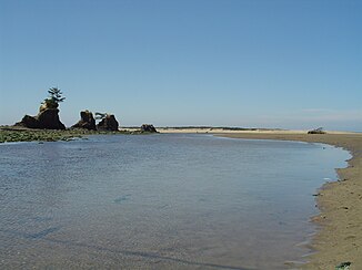
Siletz Bay, the mouth of the Siletz River in the Pacific |
||
| Data | ||
| Water code | US : 1149473 | |
| location | Oregon, United States | |
| River system | Siletz River | |
| origin | at Monmouth 44 ° 49 ′ 41 ″ N , 123 ° 34 ′ 10 ″ W. |
|
| muzzle | South of Lincoln City in the Pacific Coordinates: 44 ° 54 ′ 12 " N , 124 ° 0 ′ 41" W 44 ° 54 ′ 12 " N , 124 ° 0 ′ 41" W |
|
| Height difference | 213 m | |
| Bottom slope | 1.9 ‰ | |
| length | 113 km | |
| Drain |
NNQ (1934) MQ HHQ (1996) |
7.28 m³ / s 31.08 m³ / s 118.62 m³ / s |
| Small towns | Lincoln City | |
The Siletz River is an approximately 113 km long river in the US state of Oregon . It has two source streams, the South Fork and the North Fork . The South Fork rises 213 meters above sea level in the Oregon Coast Range near Monmouth in Polk County west of the Willamette River valley . It flows in a strongly curvy course through the coastal region of Oregon and changes its flow direction several times before it flows into the Pacific in Siletz Bay south of Lincoln City .
Its name goes back to the Indian tribe of the Siletz , the southernmost tribe of the coastal Salish .
The clear upper reaches of the Siletz River is a spawning area for cutthroat trout , rainbow trout and king salmon and therefore a popular fishing river.
Individual evidence
- ^ Siuslaw National Forest - Stream & River Fishing. Retrieved June 24, 2011 .
- ↑ USGS Real Time Water Data: Siletz River. Retrieved April 27, 2011 .
- ↑ www.traveloregon.com: Siletz River. Archived from the original on June 30, 2009 ; Retrieved April 27, 2011 .
