Simpson Desert
| Basic data | |
|---|---|
| Geographic location : | 25 ° S , 138 ° E |
| Surface: | 176,500 km² |
| Annual rainfall: | 150 - 250 mm |
| Average daily maximum temperature: |
30 ° C |
 "Big Red" sand dune |
|
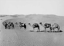
The Simpson Desert ( English Simpson Desert ) is an Australian desert . It lies for the most part in the Northern Territory and extends over an area of 176,500 km². The annual rainfall is less than 150 mm. The daytime temperatures can rise to 50 degrees Celsius in the summer months .
location
To the west the Finke River and the Mabel Range form the border of the desert. In the north it merges into the Adam Range , while the Georgina and Diamantina Rivers represent the eastern border. Lake Eyre is to the south .
Discovery story
The desert was named by the explorer and geologist Cecil Madigan after Allen Simpson , an Australian philanthropist and geographer. The explorer Charles Sturt was the first European to visit this region in 1845. It wasn't until 1936 that Edmund Colson became the first white man to cross the entire desert.
description
Under the Simpson Desert lies the Great Artesian Basin , a large groundwater reservoir . From this water comes to the surface in several places, both naturally through artesian springs (especially in Dalhousie ) and through drilling. Due to the enormous exploitation of the groundwater reservoir in recent years, the amount of water has decreased considerably and the springs are threatened to dry up completely.
The longest parallel north-south sand dunes in the world are located in the Simpson Desert. They are held in place by the sparse vegetation and are between 3 m in the west and 30 m in the east. The most famous dune, "Nappanerica" or "Big Red", is 40 m high.
There are no roads through this desert. The few slopes that were laid out by geologists in the 1960s and 1970s can only be used by well-equipped all-wheel drive vehicles. Starting points are the towns of Oodnadatta in the west and Birdsville in Queensland . A section of the Commonwealth Railway Trans-Australian Line traverses the western part of the Simpson Desert.
The South Australian Department for Environment and Heritage (DEH) decided in November 2008 to close the Simpson Desert to tourists between December and March.
The Simpson Desert National Park has protected part of the desert area in Queensland since 1967 .
Flora and fauna
Compared to other Australian deserts, the Simpson Desert receives little rainfall. It's too dry even for the tough acacia and eucalyptus trees that shape the appearance of other deserts, and bushes take their place. The closer you get to the center of the desert, the more the bush vegetation recedes, and soon spinifex grasses are the only plants that can still be found. They are shaped like small bushes and are the habitat and food for the animals in the region.
Web links
Individual evidence
- ↑ The Outback Australia Travel Guide: Australian Deserts
- ↑ australiangeographic.com ( Memento of the original dated October 6, 2009 in the Internet Archive ) Info: The archive link was inserted automatically and has not yet been checked. Please check the original and archive link according to the instructions and then remove this notice. : Kathy Riley: Reading the Simpson Desert , May 28, 2009, in English, accessed December 1, 2012
- ↑ environment.sa.gov.au: Simpson Desert closed during summer to ensure visitor safety ( Memento from October 20, 2009 in the Internet Archive ) (November 11, 2008)

