Solygia
|
Solygia parish Δημοτική Ενότητα Σολυγείας (Σολυγεία) |
||
|---|---|---|
|
|
||
| Basic data | ||
| State : |
|
|
| Region : |
Peloponnese
|
|
| Regional District : | Corinthia | |
| Municipality : | Corinth | |
| Geographic coordinates : | 37 ° 48 ' N , 23 ° 4' E | |
| Height above d. M .: | 0 - 900 m | |
| Area : | 179.461 km² | |
| Residents : | 2,723 (2011) | |
| Population density : | 15.2 inhabitants / km² | |
| Code No .: | 420104 | |
| Structure: |
1 city district 2 local communities |
|
| Located in the Corinth Municipality and the Korinthia Regional Unit | ||
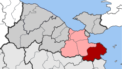
Solygia has been a parish in the Corinth parish in the east of the Korinthia regional district since January 1, 2011 . Before the Kallikratis reform , Solygia was an independent community. The seat of the former municipality was Sofiko . The municipality was named after the ancient city of Solygeia , which was not within the municipality, but in the neighboring municipality of Saronikos .
structure
The municipality of Solygia is divided into one district and two local communities.
The population figures come from the results of the 2011 census.
- Municipality of Solygia (Δημοτική Ενότητα Σολυγείας) 2,723 inhabitants (179.461 km²)
- Sofiko district (Δημοτική Κοινότητα Σοφικού) 2009
- Agios Vlassis (Άγιος Βλάσσης) 38
- Kiourkati (Κιουρκάτι) 48
- Moni Agias Marinas (Μονή Αγίας Μαρίνης) 31
- Pefkali (Πευκάλι) 204
- Sofiko (Σοφικό) 1,679
- Frangolimano (Φραγκολίμανο) 9
- Local community Angelokastro (Τοπική Κοινότητα Αγγελόκαστρου) 376
- Angelokastro (Αγγελόκαστρο) 376
- Local community of Korfos (Τοπική Κοινότητα Κόρφου) 338
- Agios Petros (Άγιος Πέτρος) 20
- Kavos (Κάβος) 17
- Ilios (Ήλιος) 14
- Korfos (Κόρφος) 287
- Sofiko district (Δημοτική Κοινότητα Σοφικού) 2009
Individual evidence
- ↑ a b Results of the 2011 census at the National Statistical Service of Greece (ΕΛ.ΣΤΑΤ) ( Memento from June 27, 2015 in the Internet Archive ) (Excel document, 2.6 MB)

