Sombrerete
| Sombrerete | ||
|---|---|---|
|
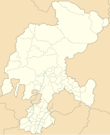
Coordinates: 23 ° 38 ′ N , 103 ° 38 ′ W Sombrerete on the map of Zacatecas
|
||
| Basic data | ||
| Country | Mexico | |
| State | Zacatecas | |
| Municipio | Sombrerete | |
| City foundation | 1555 | |
| Residents | 21,702 (2010) | |
| City insignia | ||
| Detailed data | ||
| surface | 6.53 km 2 | |
| Population density | 3,323 inhabitants / km 2 | |
| height | 2350 m | |
| Website | ||
| Sombrerete - cityscape with churches | ||
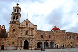
| Sombrerete - Franciscan Church with Capilla abierta | ||
Sombrerete is a city with about 25,000 inhabitants in the Mexican state of Zacatecas ; it is also the administrative seat of the municipality of the same name ( municipio ) with around 65,000 inhabitants. Since 2010, the city is part of the Camino Real de Tierra Adentro for World Heritage ; she is also one of the Pueblos Mágicos .
Location and climate
The city of Sombrerete is about 800 km (driving distance) northwest of Mexico City at an average altitude of about 2350 m ; the city of Zacatecas is about 166 km in a south-westerly direction. The climate is temperate to cool because of the altitude; Rain (approx. 620 mm / year) falls predominantly in the summer half of the year.
Population development
| year | 2000 | 2005 | 2010 |
| Residents | 18,668 | 19,353 | 21,702 |
The slight but steady increase in population is mainly due to the ongoing immigration of families from the surrounding villages.
economy
In the area there were several mines (mainly silver, lead, etc.) that were exploited from the 16th to the 18th century. Today, animal husbandry (cattle, sheep, goats, pigs) plays the most important role in the life of the community; In addition, the cultivation of grain (maize, wheat, barley) and the cultivation of fruit and vegetables (beans, chillies, tomatoes, prickly pears, peaches, pears, figs, etc.) are important. Small traders, craftsmen and service providers of all kinds have settled in the city itself.
history
Around 900, the region around Sombrerete belonged to the tribal area of the largely settled Chalchihuit Indios, who were, however, ousted by the nomadic Chichimecs in the following period. In 1555 the place was founded under the leadership of the conquistador Juan de Tolosa to secure the nearby silver mines and the Camino Real de Tierra Adentro , which led from Mexico City to the "silver cities" of the north. The importance of the settlement grew; A Real Caja was set up here in the 17th century .
Attractions
- The main attractions of the city are its numerous churches, whose origins range from the baroque to the neoclassical. Double and single-tower facades with a mostly richly decorated middle section alternate, but they all have an illuminated dome over the crossing .
- Surroundings
- The pre-Hispanic archaeological site of Altavista, which is unique in northern Mexico, is located at about 20 south-west of Chalchihuites . The “column room” with 28 columns is particularly impressive.
- Approx. 15 km northwest of the village is the Sierra de Órganos National Park with its sometimes bizarre rock formations.


