Souris River
|
Souris River, Rivière Souris, Mouse River |
||
|
Course of the Souris River |
||
| Data | ||
| location |
Saskatchewan , Manitoba ( Canada ), North Dakota (USA) |
|
| River system | Nelson River | |
| Drain over | Assiniboine River → Red River of the North → Nelson River → Hudson Bay | |
| source | in the Yellow Grass Marshes north of Weyburn, 49 ° 48 ′ 55 " N , 103 ° 42 ′ 4" W |
|
| muzzle | in the Assiniboine River coordinates: 49 ° 39 ′ 54 " N , 99 ° 34 ′ 7" W 49 ° 39 ′ 54 " N , 99 ° 34 ′ 7" W
|
|
| length | 700 km | |
| Catchment area | approx. 61,100 km² | |
| Discharge at the Wawanesa A Eo gauge : 61,100 km² |
MQ 1912/2000 Mq 1912/2000 |
12.7 m³ / s 0.2 l / (s km²) |
| Left tributaries | Antler River , Plum Creek | |
| Reservoirs flowed through | Rafferty Dam , Alameda Dam | |
| Medium-sized cities | Minot | |
| Small towns | Estevan , Weyburn | |
| Communities | Souris | |
|
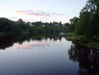
Souris River near Souris (Manitoba) |
||
The Souris River or Mouse River ( French or English : Mouse River ) is an approx. 700 km long right tributary of the Assiniboine River .
The river flows through the Canadian provinces of Saskatchewan and Manitoba and through the US state of North Dakota . The river flows into the Assiniboine River at Treesbank .
In the summer of 2011 there was a flood of the century on the Souris River near Minot , in which over 11,000 people had to be evacuated due to the floods.
Tributaries
Web links
Commons : Souris River - collection of images, videos and audio files
Individual evidence
- ↑ a b Souris River at the Wawanesa gauge - hydrographic data from R-ArcticNET

