Spetze
| Spetze | ||
|
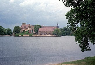
Large castle pond in Flechtingen, left of the castle drain to the small castle pond to the north |
||
| Data | ||
| Water code | DE : 4812 (with big race) | |
| location | Saxony-Anhalt , district of Börde | |
| River system | Weser | |
| Drain over | Aller → Weser → North Sea | |
| Hydrological source | on the L at 43 Behndorf 52 ° 19 '2 " N , 11 ° 10' 29" O |
|
| Source height | < 140 m ..................................... 2nd step: drainage from the castle pond Flechtingen 52 ° 11 ′ 43.77 "N, 9 ° 24 ′ 29.2" E |
|
| muzzle | at Lockstedt in the Aller coordinates: 52 ° 22 ′ 41 ″ N , 11 ° 4 ′ 16 ″ E 52 ° 22 ′ 41 ″ N , 11 ° 4 ′ 16 ″ E
|
|
| length | specifically 16 km, with the Great Race 23.07 km |
|
| Catchment area | 111.3 km² | |
The Spetze is a brook in Saxony-Anhalt that begins as an outflow from the Flechtingen Castle pond and flows into the Aller after 15.5 km at Lockstedt . Its upper course is defined as the Große Renne, which rises southwest of Flechtingen and flows into the castle pond (GKZ 48121 and 48123). The Spetzeniederung includes the towns of Lockstedt, Rätzlingen , Kathendorf , Etingen , Everingen and Eickendorf and is designated as a priority area for flood protection. The Spetze valley floodplain consists mainly of grassland.
course
Great race
The Große Renne rises on the country road from Flechtingen to Behnsdorf about 1 km before the latter in the saddle between the hills Hasenberg and Flechtinger Berg. It flows eastward for the first four and a half kilometers. Already after 1.7 km the 4.2 km long Schenkenriethe flows from the right, the flow path from its origin to the confluence of the Spetze in the Aller is 26.27 km, while the hydrographically defined body of water consists of Großer Renne, Flechtinger Schlossteich and Spetze measures only 23.07 km. At the end of the eastward section flows from the right to 105 m above sea level. NHN the Sägemühlenbach. Immediately afterwards, the Große Renne turns north and flows into the Flechtinger Schlossteich after 1.23 km.
Flechtinger Schlossteich
The Flechtinger Schlossteich has a north-south extension of 830 m with a width of up to 400 m. Its mirror is 97.6 m above sea level. It is divided into three parts by bridge embankments, through which the river flows from the mouth of the Große Renne to the outflow of the Spetze from south to north.
Spetze
The Spetze leaves the Flechtinger Schloßteich near the western corner of its northern bank and first crosses Behnsdorfer Straße. After a few meters it turns to the northeast. At the end of the village it turns in a northerly direction and describes a wide arc to the west up to its mouth. In its course it takes up several ditches and tributaries, including the Streenriethe from the right near Böddensell , the Schönekenriethe from the left, the Sohlgraben near Grauingen , the Krummbek near Etingen and the Renngraben near Everingen, which is interrupted there and its western part the lower reaches the Spetze is accompanied over a length of approx. 2.5 km at a distance of about 100 m, but flows separately into the Aller.
fauna
Occurrences of eel, perch, chub, pike, carp, roach, tench and pikeperch are known from the Spetze.
Individual evidence
- ↑ Spetze – Große Renne – Schenkenriethe as a GPS track . When drawing, the distances from the mouth to the outflow of the castle pond and the source of the Great Run were also measured
- ↑ Saxony-Anhalt Viewer - Map content: Water data including "Aboveground water catchment areas", plus measurement function: Area
- ↑ Historical Commission of the Province of Saxony (ed.): Descriptive representation of the older architectural and art monuments of the Province of Saxony and adjacent areas , Volume XX. Notebook. Gardelegen district. Otto Hendel, Halle an der Saale 1897.
- ↑ List of waters of considerable importance for water management. Appendix 3 (to Section 69 Paragraph 1 No. 2) . In: Water Act for the State of Saxony-Anhalt of April 12, 2006 (repealed) .
- ^ Landgesellschaft Sachsen-Anhalt mbH: Land use plan "City of Oebisfelde-Weferlingen". Reason. Draft. May 12, 2014. ( Page no longer available , search in web archives ) Info: The link was automatically marked as defective. Please check the link according to the instructions and then remove this notice.
- ↑ Spetze water profile . anglermap.de. 2016.
