Spitzberg (Burgkunstadt)
| Spitzberg | ||
|---|---|---|
|
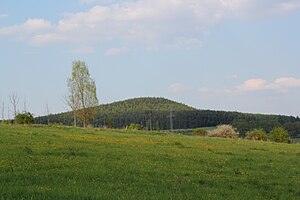
The Spitzberg from the southwest |
||
| height | 521 m above sea level NHN | |
| location | District of Lichtenfels , Upper Franconia , Bavaria , Germany | |
| Mountains | Kirchleuser Platte ( Upper Main Hill Country ) | |
| Dominance | 1.24 km → Rainberg | |
| Notch height | 48 m ↓ soldiers trench | |
| Coordinates | 50 ° 9 ′ 30 ″ N , 11 ° 20 ′ 19 ″ E | |
|
|
||
| Development | Dirt road to the summit | |
| Normal way | from Gartenroth in 30 minutes | |
The Spitzberg is 521 m above sea level. NHN high mountain on the Kirchleuser Platte in the hill country of Upper Main near Gärtenroth . It represents the highest point in the urban area of Burgkunstadt .
The Spitzberg rises, if one compares the two official height specifications, 138.2 m above the Burgkunstadter district Gärtenroth . The dominance to the next higher mountain, the Rainberg near Küps, is 1.24 km. The notch height to the soldiers ditch , which lies between the Rainberg and the Spitzberg, is 48 m.
Others
In the book Spitzberch: Frankenkrimi by Jacqueline Reese , the mountain plays a major role, which is why the novel is titled after the mountain in a spelling based on Franconian.
Individual evidence
- ↑ a b c Spitzberg, Militärgraben and Rainberg in the Bayern Viewer , geodaten.bayern.de, accessed on December 28, 2011


