Gardens red
|
Gardens red
City of Burgkunstadt
Coordinates: 50 ° 8 ′ 40 ″ N , 11 ° 19 ′ 59 ″ E
|
||
|---|---|---|
| Height : | 376 (363-387) m | |
| Residents : | 220 (May 9, 2014) | |
| Incorporation : | January 1, 1977 | |
| Area code : | 09229 | |
|
Location of Gartenroth in Bavaria |
||
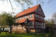
Gartenroth is a parish village with 220 inhabitants and a district of Burgkunstadt in the Lichtenfels district .
Geographical location
The village Gartenroth is 363 to 387 m above sea level. Sea level on a gently sloping high plateau of the Lias, sloping towards the north and a good hundred meters high from the south . The official height is 379 m above sea level. NN specified. Gartenroth is located in the northeast of the Burgkunstadter urban area between Lichtenfels and Kulmbach . Immediately north of the village is the Spitzberg (517.6 m above sea level). Due to its location near the Main , Gartenroth is part of the Upper Main Land of Bruchschollenland . The center of Burgkunstadt is around six kilometers to the west.
history
- Historical views of Gartenroth
At the beginning of the 10th century, the lands on which gartenroth is located were cleared due to the fertile soil and settled for the first time. The clearing was most likely carried out on a sovereign order, as a noble knight dynasty in gartenroth was documented as early as 1100.
The settlement village "Gerentenrode" with the owner "Degeno von Gerendenrode" was first mentioned when Bishop Otto von Bamberg consecrated the predecessor of today's church there in 1108. The name of the place refers to the founder Gerend or Gerhard. The church was built by Priest Walraban on part of his estate. Walraban was one of the three sons of Degeno von Gerendenrode, along with Ougalrich and Willihalm. With the consecration of the church, the village received the tithe of the four settlements Ebersreuth, Hartmannsreuth, Vitose (Weides near Hain ) and Willenberge (= Wildenroth ).
In 1328 the village came as a fief into possession of the family of Redwitz that the nearby castle Wildenroth resided. As a result of the Reformation in the Kulmbach Markgraftum in 1529, the church became an aristocratic own church again. In this year, Georg Marr, the first Protestant pastor was appointed. The rectory was built in 1707 under the pastor Georg Gottfried Eberlin, and was extensively restored only a few years ago.
Around 1800 the place "Gertenrod" was written. His tithe was due to the Bamberg Office of Weismain .
Gartenroth became its own political municipality in 1818, together with the hamlets of Eben, Flurholz, Lopphof, Wildenroth and Schubertsreuth, which has since disappeared . In 1875 a school house was built, which was demolished in 1909 after the construction of the next building with a teacher's apartment.
On January 1st 1977, Gartenroth with its districts Wildenroth, Lopphof, Eben and Flurholz was incorporated into the town of Burgkunstadt. The through-town got its current shape when it was widened in 1978.
Population development
The table shows the development of the residents in Gärtenroth.
| year | Residents | source |
|---|---|---|
| 1987 | 236 | |
| 2001 | 248 | |
| 2002 | 242 | |
| 2003 | 244 | |
| 2004 | 247 | |
| 2005 | 235 | |
| 2006 | 250 | |
| 2007 | 237 | |
| 2008 | 231 | |
| 2009 | 215 | |
| 2010 | 219 |
mayor
- Around 1928: Johann Gebelein
Individual evidence
- ↑ a b c d e Annual report of the city of Burgkunstadt from 2010 , publish.kommonline-gmbh.de, accessed on December 27, 2011
- ↑ a b c d e f g Franz Wenzl: The districts of the city of Burgkunstadt with pictures from bygone days. Geiger Verlag, Horb am Neckar 1991, ISBN 3-89264-247-8 , p. 6 ff.
- ↑ a b c d e history of gardens red, burgkunstadt.eu, accessed on December 27, 2011
- ↑ Gartenroth in Bayernviewer , geodaten.bayern.de, accessed on October 11, 2019
- ↑ a b c d e Bayern 1 Zwölfuhrluten Gärtenroth in Upper Franconia ( Memento from August 18, 2010 in the Internet Archive ), br-online.de, accessed on December 27, 2011
- ^ GoogleBooks Geographical, statistical-topographical lexicon of Franconia by Johann Kaspar Bundschuh
- ↑ Genealogical place directory of Gärtenroth , gov.genealogy.net, accessed on December 27, 2011
- ↑ a b c Annual report of the city of Burgkunstadt from 2006 , publish.kommonline-gmbh.de, accessed on December 27, 2011
- ↑ a b c Annual report of the city of Burgkunstadt from 2007 , publish.kommonline-gmbh.de, accessed on December 27, 2011
Web links
literature
- Karl Bauersachs: From gardens red - dialect poems , gardens red 2002, length: 40 pages
- Evangelical Parish Church Garden Red (Ed.): 900 Years Parish Church Garden Red , Garden Red 2008, Extent: 64 pages
- Volunteer Fire Brigade Gardensroth (Ed.): 125 years of Volunteer Fire Brigade Gardensroth , Gardensroth 2002, length: 128 pages
- Stephan Kempe: A picture on the stone - the Volto-Santo relief near Gartenroth . In: Heimatgeschichtliche Zeitschrift für der Landkreis Lichtenfels , Volume 15 - 2006, Verlag Vom Main zum Jura, Eggolsheim 2006, pp. 7–31


