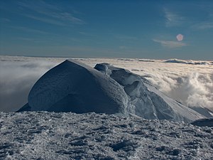
St. Boris Peak
| St. Boris Peak | ||
|---|---|---|
|
View from Mount Friesland to St. Boris Peak |
||
| height | 1665 m | |
| location | Livingston Island , South Shetland Islands | |
| Mountains | Tangra Mountains | |
| Coordinates | 62 ° 40 '32 " S , 60 ° 11' 41" W | |
|
|
||
| First ascent | Doitschin Boyanov and Nikolai Petkow on December 23, 2016 | |
|
Map of the Tangra Mountains with St. Boris Peak |
||
The St. Boris Peak ( Bulgarian Връх Свети Борис Wrach Sweti Boris ) is a 1665 m high mountain on Livingston Island in the archipelago of the South Shetland Islands . In the Friesland Ridge of the Tangra Mountains, it rises above the Huntress and Macy glaciers 650 m south-southwest of Mount Friesland and 3.75 km south-southeast of the Plíska Ridge .
Bulgarian scientists carried out surveys from 1995 to 1996. The Bulgarian Commission for Antarctic Geographical Names named the mountain in 2002 after Boris I († 907), national saint of Bulgaria. On December 23, 2016, Doitschin Bojanow and Nikolai Petkow climbed the mountain for the first time. They determined its height by DGPS at 1699 m. That was six meters more than they had previously determined for the neighboring and officially highest mountain in the Tangra Mountains, Mount Friesland .
Web links
- St. Boris Peak in the Composite Gazetteer of Antarctica (English)
Individual evidence
- ↑ a b НСА за трети път в Антарктика on the website of the Bulgarian Sports Academy 2017, accessed on November 25, 2018 (Bulgarian).


